Ljubotinj
|
Cetinje Цетиње |
|||
|---|---|---|---|
| City | |||
 |
|||
|
|||
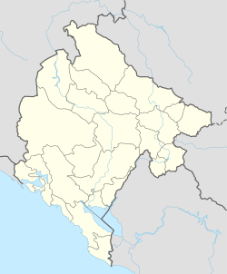
| Location of Cetinje | |||
| Coordinates: 42°23′N 18°55′E / 42.38°N 18.92°ECoordinates: 42°23′N 18°55′E / 42.38°N 18.92°E | |||
| Country | Montenegro | ||
| Municipality | Cetinje | ||
| Status | Old Royal Capital | ||
| Founded | 15th century | ||
| Settlements | 94 | ||
| Government | |||
| • Mayor | Aleksandar Bogdanović (DPS) | ||
| • Ruling party | DPS | ||
| Area | |||
| • Total | 910 km2 (350 sq mi) | ||
| Elevation | 650 m (2,130 ft) | ||
| Population (2003 census) | |||
| • Total | 15,137 | ||
| • Density | 20/km2 (50/sq mi) | ||
| • Municipality | 18,482 | ||
| Time zone | CET (UTC+1) | ||
| • Summer (DST) | CEST (UTC+2) | ||
| Postal code | 81250 | ||
| Area code | +382 41 | ||
| ISO 3166-2 code | ME-06 | ||
| Car plates | CT | ||
| Climate | Cfb | ||
| Website | http://www.cetinje.me/ | ||
Cetinje (Montenegrin Cyrillic: Цетиње [pronounced [ t͡sětiɲe]]), is a city and Old Royal Capital (Montenegrin: Prijestonica / Приjестоница) of Montenegro. It is also the historic and the secondary capital of Montenegro, where the official residence of the President of Montenegro is located. It had a population of 13,991 as of 2011[update].
Cetinje is the centre of Cetinje Municipality (population 16,757 in 2011). The city rests on a small karst plain surrounded by limestone mountains, including Mt. Lovćen, the Black Mountain from which Montenegro derives its name.
Cetinje is a town of great historical significance, being founded in the 15th century and because it became the center of Montenegrin life and both a cradle of Montenegrin culture and an Orthodox religious center. Its status as the honorary capital of Montenegro is due to its heritage as a long-serving former capital of Montenegro.
In Montenegrin and Serbian the town is known as Цетиње / Cetinje (archaically Цетинѣ / Cetině); in Italian as Cettigne; in Greek as Κετίγνη (Ketígni); in Turkish as Çetince; and in Albanian as Cetina.
...
Wikipedia


