Littlestown
| Littlestown, Pennsylvania | |
|---|---|
| Borough | |

Pavillon in Crouse Park
|
|
| Motto: We're growing, one neighbor at a time | |
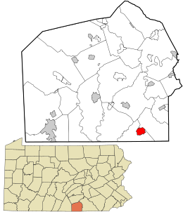
 Location in Adams County and the state of Pennsylvania. |
|
| Location in Pennsylvania and the United States | |
| Coordinates: 39°44′37″N 77°05′21″W / 39.74361°N 77.08917°WCoordinates: 39°44′37″N 77°05′21″W / 39.74361°N 77.08917°W | |
| Country | United States |
| State | Pennsylvania |
| County | Adams |
| Settled | 1765 |
| Incorporated | 1864 |
| Government | |
| • Type | Borough Council |
| • Mayor | James Eline, Sr. |
| Area | |
| • Total | 1.50 sq mi (3.89 km2) |
| • Land | 1.50 sq mi (3.89 km2) |
| • Water | 0.00 sq mi (0.00 km2) |
| Elevation | 627 ft (191 m) |
| Population (2010) | |
| • Total | 4,434 |
| • Estimate (2016) | 4,468 |
| • Density | 2,972.72/sq mi (1,147.88/km2) |
| Time zone | Eastern (EST) (UTC-5) |
| • Summer (DST) | EDT (UTC-4) |
| Zip code | 17340 |
| Area code(s) | 717 Exchanges: 345,359 |
| FIPS code | 42-43944 |
| Website | www |
Littlestown is a borough in Adams County, Pennsylvania, United States. The population was 4,434 at the 2010 census.
Originally laid out by Peter Klein in 1760, the town was first named "Petersburg". German settlers in the area came to call the town "Kleine Stedtle". As confusion between the town and a neighboring town (also named "Petersburg", now York Springs) grew, the town officially changed its name to Littlestown (essentially a translation of "Kleine Stedtle" from German) in 1795.
Littlestown is located at 39°44′37″N 77°5′21″W / 39.74361°N 77.08917°W (39.743749, -77.089240). According to the United States Census Bureau, the borough has a total area of 1.6 square miles (4.1 km2), all of it land.
Littlestown is surrounded by three larger towns -- Hanover, Gettysburg, and Westminster—all within 10 to 20 miles (32 km) driving distance.
As of the census of 2000, there were 3,947 people, 1,586 households, and 1,113 families residing in the borough. The population density was 2,517.0 people per square mile (970.7/km²). There were 1,692 housing units at an average density of 1,079.0 per square mile (416.1/km²). The racial makeup of the borough was 97.26% White, 0.56% African American, 0.10% Native American, 0.43% Asian, 0.51% from other races, and 1.14% from two or more races. Hispanic or Latino of any race were 1.27% of the population.
...
Wikipedia


