Litchfield, NH
| Litchfield, New Hampshire | ||
|---|---|---|
| Town | ||

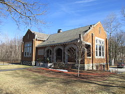
Aaron Cutler Memorial Library
|
||
|
||
 Location in Hillsborough County, New Hampshire |
||
| Coordinates: 42°50′39″N 71°28′47″W / 42.84417°N 71.47972°WCoordinates: 42°50′39″N 71°28′47″W / 42.84417°N 71.47972°W | ||
| Country | United States | |
| State | New Hampshire | |
| County | Hillsborough | |
| Incorporated | 1734 | |
| Government | ||
| • Board of Selectmen | Brent Lemire, Chair Kevin Bourque John Brunelle Steve Perry Kurt Schaefer |
|
| • Town Administrator | Troy Brown | |
| Area | ||
| • Total | 15.4 sq mi (40.0 km2) | |
| • Land | 15.1 sq mi (39.1 km2) | |
| • Water | 0.3 sq mi (0.9 km2) 2.27% | |
| Elevation | 127 ft (39 m) | |
| Population (2010) | ||
| • Total | 8,271 | |
| • Density | 540/sq mi (210/km2) | |
| Time zone | Eastern (UTC-5) | |
| • Summer (DST) | Eastern (UTC-4) | |
| ZIP code | 03052 | |
| Area code(s) | 603 | |
| FIPS code | 33-42260 | |
| GNIS feature ID | 0873648 | |
| Website | www |
|
Litchfield is a town in Hillsborough County, New Hampshire, United States. The population was 8,271 at the 2010 census.
Originally known as Naticook, the name was changed to Brenton's Farm in 1729 when the land was granted to William Brenton, colonial governor of Rhode Island. The town was incorporated in 1734. After Brenton's death in 1749, the land was granted to another group of settlers and named Litchfield after George Henry Lee, Earl of Lichfield.
Wiseman Claget moved to his substantial estates here shortly before the Revolution. He was involved in the temporary government serving as the only Solicitor General, the post being abolished shortly before his death in 1784.
According to the United States Census Bureau, the town has a total area of 15.4 square miles (40 km2), of which 15.1 sq mi (39 km2) is land and 0.3 sq mi (0.78 km2) is water, comprising 2.27% of the town. The highest point in Litchfield is the summit of Rocky Hill, at 357 feet (109 m) above sea level. The town is bordered to the north by Manchester, to the east by Londonderry in Rockingham County, to the south by Hudson, and to the west by Merrimack, with the Merrimack River separating the two towns. There is no bridge connecting Litchfield and Merrimack; the closest river crossings are to the south between Nashua and Hudson, and to the north between Manchester and Bedford.
As of the census of 2000, there were 7,360 people, 2,357 households, and 2,031 families residing in the town. The population density was 487.5 people per square mile (188.2/km²). There were 2,389 housing units at an average density of 158.3 per square mile (61.1/km²). The racial makeup of the town was 97.72% White, 0.53% African American, 0.29% Native American, 0.57% Asian, 0.15% from other races, and 0.75% from two or more races. Hispanic or Latino of any race were 0.83% of the population.
...
Wikipedia

