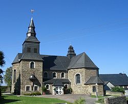
Lingerhahn
| Lingerhahn | ||
|---|---|---|

Church
|
||
|
||
| Coordinates: 50°5′44″N 7°33′57″E / 50.09556°N 7.56583°ECoordinates: 50°5′44″N 7°33′57″E / 50.09556°N 7.56583°E | ||
| Country | Germany | |
| State | Rhineland-Palatinate | |
| District | Rhein-Hunsrück-Kreis | |
| Municipal assoc. | Emmelshausen | |
| Government | ||
| • Mayor | Andreas Nick | |
| Area | ||
| • Total | 6.01 km2 (2.32 sq mi) | |
| Elevation | 482 m (1,581 ft) | |
| Population (2015-12-31) | ||
| • Total | 450 | |
| • Density | 75/km2 (190/sq mi) | |
| Time zone | CET/CEST (UTC+1/+2) | |
| Postal codes | 56291 | |
| Dialling codes | 06746 | |
| Vehicle registration | SIM | |
Lingerhahn is an Ortsgemeinde – a municipality belonging to a Verbandsgemeinde, a kind of collective municipality – in the Rhein-Hunsrück-Kreis (district) in Rhineland-Palatinate, Germany. It belongs to the Verbandsgemeinde of Emmelshausen, whose seat is in the like-named town.
The municipality lies in the central Hunsrück between Emmelshausen and Kastellaun, right on the Schinderhannes-Radweg (cycle path) and not far from the Autobahn A 61 (Pfalzfeld interchange).
Yearly precipitation in Lingerhahn amounts to 758 mm, which falls into the middle third of the precipitation chart for all Germany. At 54% of the German Weather Service’s weather stations, lower figures are recorded. The driest month is February. The most rainfall comes in June. In that month, precipitation is 1.6 times what it is in February. Precipitation varies only slightly. Only at 4% of the weather stations are lower seasonal swings recorded.
North of Lingerhahn in 1873, in the cadastral area known as “Mohr”, remnants of a Roman villa rustica were unearthed. These remnants amounted to “plates made of fired clay as well as clay pipes and remnants of ashes”, although according to witnesses, coins were also found. Right nearby, a road, which had already existed before Roman times, led from the Rhine to the Moselle (today’s Hauptstraße, continuation: “Karrenstraße”).
...
Wikipedia


