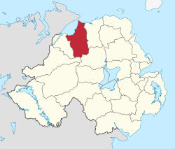
Limavady Borough Council
| Limavady Borough | |
|---|---|
 |
|
| Area | 586 km2 (226 sq mi) Ranked 10th of 26 |
| District HQ | Limavady |
| Catholic | 56.6% |
| Protestant | 41.6% |
| Country | Northern Ireland |
| Sovereign state | United Kingdom |
| EU Parliament | Northern Ireland |
| Councillors |
|
| Website | www |
Coordinates: 55°03′04″N 6°57′04″W / 55.051°N 6.951°W
Limavady Borough Council (Irish: Comhairle Bhuirg Léim an Mhadaidh) is a local government body in Northern Ireland. In May 2015 it merged with Coleraine Borough Council, Ballymoney Borough Council and Moyle District Council under local government reorganisation in Northern Ireland to become Causeway Coast and Glens District Council.
Its headquarters are in the town of Limavady, although 63% of the population lives in a rural setting. It covers an area of 586 square kilometres and includes the valley of the River Roe. It stretches from the Sperrin Mountains in the south to Benone beach, a seven-mile strand on the Atlantic coast which was the first beach in Northern Ireland to be awarded a Blue Flag. Apart from Limavady other towns in the area include Dungiven and Ballykelly.
The Limavady Borough Council area consists of three electoral areas: Limavady Town, Benbradagh and Bellarena. The Council was established in 1973 and is made up of 15 members who are elected (normally for a four-year term) using a single transferable vote system.
...
Wikipedia
