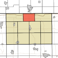
Lima Township, LaGrange County, Indiana
| Lima Township | |
|---|---|
| Township | |

Shops in the center of Howe, one of the township's villages
|
|
 |
|
| Coordinates: 41°43′48″N 85°25′32″W / 41.73000°N 85.42556°WCoordinates: 41°43′48″N 85°25′32″W / 41.73000°N 85.42556°W | |
| Country | United States |
| State | Indiana |
| County | LaGrange |
| Government | |
| • Type | Indiana township |
| Area | |
| • Total | 25.1 sq mi (65 km2) |
| • Land | 24.45 sq mi (63.3 km2) |
| • Water | 0.65 sq mi (1.7 km2) |
| Elevation | 879 ft (268 m) |
| Population (2010) | |
| • Total | 2,507 |
| • Density | 102.5/sq mi (39.6/km2) |
| FIPS code | 18-43722 |
| GNIS feature ID | 453569 |
Lima Township is one of eleven townships in LaGrange County, Indiana. As of the 2010 census, its population was 2,507 and it contained 1,008 housing units.
Lima Township was established in 1832.
John Badlam Howe Mansion, St. James Memorial Chapel, Star Milling and Electric Company Historic District, and Samuel P. Williams House are listed on the National Register of Historic Places.
According to the 2010 census, the township has a total area of 25.1 square miles (65 km2), of which 24.45 square miles (63.3 km2) (or 97.41%) is land and 0.65 square miles (1.7 km2) (or 2.59%) is water.
...
Wikipedia
