Lilongwe International Airport
| Lilongwe International Airport Kamuzu International Airport |
|||||||||||
|---|---|---|---|---|---|---|---|---|---|---|---|

Lilongwe International Airport
|
|||||||||||
| Summary | |||||||||||
| Airport type | Public | ||||||||||
| Owner | Department of Civil Aviation | ||||||||||
| Serves | Lilongwe, Malawi | ||||||||||
| Hub for | Malawian Airlines | ||||||||||
| Elevation AMSL | 4,035 ft / 1,230 m | ||||||||||
| Coordinates | 13°47′21″S 033°46′51″E / 13.78917°S 33.78083°ECoordinates: 13°47′21″S 033°46′51″E / 13.78917°S 33.78083°E | ||||||||||
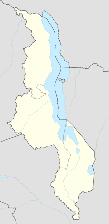
| Map | |||||||||||
| Location in Malawi | |||||||||||
| Runways | |||||||||||
|
|||||||||||
| Statistics (2009) | |||||||||||
|
|||||||||||
|
Source: DAFIF
|
|||||||||||
| Passengers | 296,190 |
|---|
Lilongwe International Airport (IATA: LLW, ICAO: FWKI) is an international airport serving Lilongwe, the capital city of Malawi. It is also known as Kamuzu International Airport.
The airport was built in 1977 by the Nello L. Teer Company, taking over most airliner operations from Old Lilongwe Airport (FWLE) some 6 km west of the city centre.
The airport resides at an elevation of 4,035 feet (1,230 m) above mean sea level. It has one runway designated 14/32 with an asphalt surface measuring 3,540 by 45 metres (11,614 ft × 148 ft).
...
Wikipedia

