Liberty Township, Warren County, Indiana
| Liberty Township | |
|---|---|
| Township | |
 Location of Liberty Township in Warren County |
|
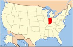
 Location of Indiana in the United States |
|
| Coordinates: 40°20′36″N 87°19′40″W / 40.34333°N 87.32778°WCoordinates: 40°20′36″N 87°19′40″W / 40.34333°N 87.32778°W | |
| Country | United States |
| State | Indiana |
| County | Warren |
| Government | |
| • Type | Indiana township |
| Area | |
| • Total | 44.02 sq mi (114.0 km2) |
| • Land | 44 sq mi (110 km2) |
| • Water | 0.02 sq mi (0.05 km2) 0.05% |
| Elevation | 679 ft (207 m) |
| Population (2010) | |
| • Total | 896 |
| • Density | 20.4/sq mi (7.9/km2) |
| Time zone | Eastern (EST) (UTC-5) |
| • Summer (DST) | EDT (UTC-4) |
| Area code(s) | 765 |
| GNIS feature ID | 453565 |
Liberty Township is one of twelve townships in Warren County, Indiana, United States. According to the 2010 census, its population was 896 and it contained 362 housing units.
Liberty Township was formed in March 1843.
The Andrew Brier House was listed on the National Register of Historic Places in 1986.
According to the 2010 census, the township has a total area of 44.02 square miles (114.0 km2), of which 44 square miles (110 km2) (or 99.95%) is land and 0.02 square miles (0.052 km2) (or 0.05%) is water. It contains the Potholes at Fall Creek Gorge, a scenic natural location owned and maintained by the Nature Conservancy. Big Pine Creek enters the township from Adams Township to the north and winds to the southeast, briefly entering Warren Township before emptying into the Wabash River near Attica. The stream of Fall Creek also runs through this township.
The north end of the county seat of Williamsport extends into the southeast corner of the township. In addition, there are three small unincorporated towns in the township. Carbondale is located just north of the point where State Road 63 begins at U.S. Route 41. Judyville is about 2 miles (3.2 km) west of Carbondale, near the western border of the township. Kramer is located about 3 miles (4.8 km) east-southeast of Carbondale, near the site of the Hotel Mudlavia. The settlement of Five Points is now defunct, but existed along the present-day route of U.S. Route 41 in the southeastern part of the township.
The township contains these five cemeteries: Bartlett, Brier, Goodwine, Kester and McCabe.
...
Wikipedia
