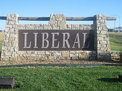
Liberal, KS
| Liberal, Kansas | |
|---|---|
| City | |

Welcome sign on U.S. Route 83 (2010)
|
|
 Location within Seward County and Kansas |
|
 KDOT map of Seward County (legend) |
|
| Coordinates: 37°2′36″N 100°55′41″W / 37.04333°N 100.92806°WCoordinates: 37°2′36″N 100°55′41″W / 37.04333°N 100.92806°W | |
| Country | United States |
| State | Kansas |
| County | Seward |
| Founded | 1888 |
| Incorporated | 1888 |
| Government | |
| • Mayor | Joe Denoyer |
| • City Manager | Mark Hall |
| Area | |
| • Total | 11.75 sq mi (30.43 km2) |
| • Land | 11.61 sq mi (30.07 km2) |
| • Water | 0.14 sq mi (0.36 km2) |
| Elevation | 2,835 ft (864 m) |
| Population (2010) | |
| • Total | 20,525 |
| • Estimate (2015) | 24,185 |
| • Density | 1,700/sq mi (670/km2) |
| Time zone | Central (CST) (UTC-6) |
| • Summer (DST) | CDT (UTC-5) |
| ZIP codes | 67901, 67905 |
| Area code(s) | 620 |
| FIPS code | 20-39825 |
| GNIS feature ID | 0470667 |
| Website | CityOfLiberal.org |
Liberal is the county seat of Seward County, Kansas, United States. As of the 2010 census, the city population was 20,525.
Early settler S. S. Rogers built the first house in what would become Liberal in 1872. Rogers became famous in the region for giving water to weary travelers. Reportedly, Liberal gained its name from the common response to his acts of kindness, "That's very liberal of you." In 1885 Rogers built a general store, and with it came an official U.S. Post Office. Rogers named the post office 'Liberal'. After the railroad was built close by, a plan for the town site was created in 1888. A year later the population was around 800.
Drought caused some farmers to give up and look for more fertile territory; however, when the nearby Indian Territory was opened, more settlers headed to the cheap land that would become Oklahoma.
Natural gas was discovered west of town, in what would become part of the massive Panhandle-Hugoton Gas Field, in 1920. Oil was discovered southwest of town in 1951. In 1963 the largest helium plant in the world, National Helium, was opened.
Liberal is located at 37°2′36″N 100°55′41″W / 37.04333°N 100.92806°W (37.043418, −100.928133) at an elevation of 2,835 feet (864 m). Located in southwestern Kansas at the intersection of U.S. Route 83 and U.S. Route 54, Liberal is 140 miles (225 km) north-northeast of Amarillo, Texas, 202 mi (325 km) west-southwest of Wichita, and 288 mi (463 km) southeast of Denver, Colorado.
...
Wikipedia
