Lenningen, Luxembourg
|
Lenningen Lenneng |
||
|---|---|---|
| Commune | ||
 |
||
|
||
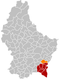
 Map of Luxembourg with Lenningen highlighted in orange, and the canton in dark red |
||
| Coordinates: 49°36′00″N 6°22′00″E / 49.6°N 6.3667°ECoordinates: 49°36′00″N 6°22′00″E / 49.6°N 6.3667°E | ||
| Country |
|
|
| Canton | Remich | |
| Government | ||
| • Mayor | Arnold Rippinger | |
| Area | ||
| • Total | 20.35 km2 (7.86 sq mi) | |
| Area rank | 56 of 105 | |
| Highest elevation | 321 m (1,053 ft) | |
| • Rank | 97th of 105 | |
| Lowest elevation | 166 m (545 ft) | |
| • Rank | 12th of 105 | |
| Population (2014) | ||
| • Total | 1,768 | |
| • Rank | 77th of 105 | |
| • Density | 87/km2 (230/sq mi) | |
| • Density rank | 65th of 105 | |
| Time zone | CET (UTC+1) | |
| • Summer (DST) | CEST (UTC+2) | |
| LAU 2 | LU00008004 | |
| Website | lenningen.lu | |
Lenningen (Luxembourgish: Lenneng) is a commune and small town in southeastern Luxembourg. The commune has a population of about 1,900. It is located about 20 km east of the capital city, Luxembourg City. The commune's administrative centre is Canach.
As of 2013[update], the town of Lenningen, which lies in the east of the commune, has a population of 385. The only other town within the commune is Canach.
...
Wikipedia

