Lengnau, Aargau
| Lengnau | ||
|---|---|---|
 |
||
|
||
| Coordinates: 47°31′N 8°20′E / 47.517°N 8.333°ECoordinates: 47°31′N 8°20′E / 47.517°N 8.333°E | ||
| Country | Switzerland | |
| Canton | Aargau | |
| District | Zurzach | |
| Area | ||
| • Total | 12.67 km2 (4.89 sq mi) | |
| Elevation | 415 m (1,362 ft) | |
| Population (Dec 2015) | ||
| • Total | 2,667 | |
| • Density | 210/km2 (550/sq mi) | |
| Postal code | 5426 | |
| SFOS number | 4312 | |
| Surrounded by | Baldingen, Böbikon, Endingen, Freienwil, Obersiggenthal, Schneisingen, Unterehrendingen, Unterendingen, Wislikofen | |
| Twin towns | Lengnau, Berne (Switzerland) | |
| Website |
www SFSO statistics |
|
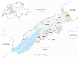
Lengnau is a municipality in the district of Zurzach in the canton of Aargau in Switzerland.
It is notable for being one of two villages where residence was permitted for Swiss Jews between 1633 and 1874. Lengnau's synagogue is listed as a heritage site of national significance.
The remains of a Roman era farm was discovered near Lengnau. The modern municipality of Lengnau is first mentioned in 798 as Lenginwanc. The Herrschaft rights were claimed by both the Bishop of Constance and the Habsburgs. After the conquest of the Aargau in 1415, the Bishop and the County of Baden continued to dispute the rights over the village. It wasn't until the late 15th Century that the rights went over entirely to the Swiss Confederation. After 1269 the low court right was held by the Teutonic Knights through their Commandry of Beuggen. Until 1400 the Bishop's vogt in Klingnau was also involved in the low court. The hamlet of Husen was under the low court of the Knights Hospitaller Commandry of Leuggern.
...
Wikipedia


