Lemsterland
|
Lemsterland Lemsterlân |
|||
|---|---|---|---|
| Former municipality | |||

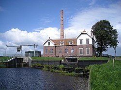
Pumping station in Echten
|
|||
|
|||
 Location in Friesland |
|||
| Coordinates: 52°51′N 5°43′E / 52.850°N 5.717°ECoordinates: 52°51′N 5°43′E / 52.850°N 5.717°E | |||
| Country | Netherlands | ||
| Province | Friesland | ||
| Dissolved | 1 January 2014 | ||
| Area | |||
| • Total | 124.34 km2 (48.01 sq mi) | ||
| • Land | 75.93 km2 (29.32 sq mi) | ||
| • Water | 48.41 km2 (18.69 sq mi) | ||
| Elevation | 0 m (0 ft) | ||
| Population (November 2013) | |||
| • Total | 13,544 | ||
| • Density | 178/km2 (460/sq mi) | ||
| Time zone | CET (UTC+1) | ||
| • Summer (DST) | CEST (UTC+2) | ||
| Postcode | 8508, 8530–8539 | ||
| Area code | 0514 | ||
Lemsterland (![]() pronunciation , West Frisian: Lemsterlân) is a former municipality in the northern Netherlands. In 2014 it merged with the municipalities of Skarsterlân and Gaasterlân-Sleat to form the new municipality De Friese Meren.
pronunciation , West Frisian: Lemsterlân) is a former municipality in the northern Netherlands. In 2014 it merged with the municipalities of Skarsterlân and Gaasterlân-Sleat to form the new municipality De Friese Meren.
...
Wikipedia


