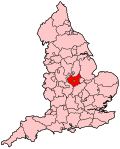
Leicester West
| Leicester West | |
|---|---|
|
Borough constituency for the House of Commons |
|

Boundary of Leicester West in Leicestershire.
|
|

Location of Leicestershire within England.
|
|
| County | Leicestershire |
| Electorate | 65,432 (December 2010) |
| Current constituency | |
| Created | 1974 |
| Member of parliament | Liz Kendall (Labour) |
| Number of members | One |
| Created from | Leicester North West and Leicester South West |
| 1918–1950 | |
| Number of members | One |
| Created from | Leicester |
| Overlaps | |
| European Parliament constituency | East Midlands |
Leicester West is a constituency represented in the House of Commons of the UK Parliament since 2010 by Liz Kendall of the Labour Party.
1918–1950: The County Borough of Leicester wards of Abbey, Newton, St Margaret's, Westcotes, and Wyggeston.
1974–1983: The County Borough of Leicester wards of Abbey, Newton, North Braunstone, St Margaret's, and Westcotes.
1983–2010: The City of Leicester wards of Abbey, Beaumont Leys, Mowmacre, New Parks, North Braunstone, Rowley Fields, St Augustine's, Westcotes, and Western Park.
2010–present: The City of Leicester wards of Abbey, Beaumont Leys, Braunstone Park and Rowley Fields, Fosse, New Parks, Westcotes, and Western Park.
The whitest of the three Leicester seats, and the one with the highest proportion of social housing. Parts of the seat like Braunstone and Beaumont Leys are made up of large local authority estates and around thirty per cent of the housing is council or housing association owned, the second highest in the Midlands. The centre of seat, the Westcote area, is more inner city in character and is popular with young professionals and students.
Historically this used to be the safest Labour seat in Leicester (in the 1983 Conservative landslide it was the only one to remain in Labour hands). However the high Asian populations in Leicester South and Leicester East have pushed them away from the Conservatives and while this is still a safe Labour seat, represented by the party since the second world war, it is the most marginal of the three Leicester seats.
Leicester West, as of 2009 and in the depth of a severe recession had the fourth highest level of unemployment in Britain, with 13.8% of residents registered unemployed. Most of the unemployment is concentrated in areas such as Braunstone, which is traditionally one of the most deprived parts of the city.
Coordinates: 52°39′N 1°10′W / 52.65°N 1.16°W
...
Wikipedia
