Braunstone Park & Rowley Fields
| Braunstone Park & Rowley Fields | |
|---|---|
 |
|
| Population | 16,614 |
| Unitary authority | |
| Ceremonial county | |
| Region | |
| Country | England |
| Sovereign state | United Kingdom |
| Post town | LEICESTER |
| Postcode district | LE3 |
| Dialling code | 0116 |
| Police | Leicestershire |
| Fire | Leicestershire |
| Ambulance | East Midlands |
| EU Parliament | East Midlands |
| UK Parliament | |
Coordinates: 52°36′N 1°10′W / 52.600°N 1.167°W
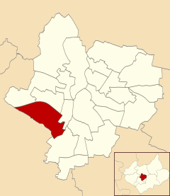
Braunstone Park & Rowley Fields is an electoral ward and administrative division of the city of Leicester, England. It comprises the western Leicester suburbs of Braunstone Frith, Braunstone Park and Rowley Fields.
Braunstone Park & Rowley Fields is bounded by the wards of New Parks and Western Park to the north, Westcotes to the east and Aylestone to the south-east. South of the ward is the district of Blaby and the town of Braunstone in Leicestershire, which has a shared history with the Leicester suburbs.
Braunstone was mentioned in the Domesday book when it was owned by Hugh de Grandmesnil. It was substantially extended in the early twentieth century, and included the first of Leicester's large estates of council housing.
Originally part of the parish of Braunstone, the area containing social housing was annexed by Leicester City Council in 1935 as the Braunstone Estate. The remainder of the build retained the Parish of Braunstone name, but was renamed in 1977 as Braunstone Town. This section was the only portion of the 1935 build to feature privately owned/saleable homes, created by the local company, Turnbull Building Co and Sons. Turnbull Drive, part of the estate, was named after the company; Edward Avenue and Francis Avenue nearby represent the then Sons of the Company owner.
...
Wikipedia
