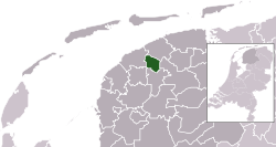
Leeuwarderadeel
|
Leeuwarderadeel Ljouwerteradiel |
|||
|---|---|---|---|
| Municipality | |||

Wind mill in Leeuwarderadeel
|
|||
|
|||
 Location in Friesland |
|||
| Coordinates: 53°16′N 5°46′E / 53.267°N 5.767°ECoordinates: 53°16′N 5°46′E / 53.267°N 5.767°E | |||
| Country | Netherlands | ||
| Province | Friesland | ||
| Government | |||
| • Body | Municipal council | ||
| • Mayor | Joop Boertjens (VVD) | ||
| Area | |||
| • Total | 41.46 km2 (16.01 sq mi) | ||
| • Land | 40.91 km2 (15.80 sq mi) | ||
| • Water | 0.55 km2 (0.21 sq mi) | ||
| Elevation | 1 m (3 ft) | ||
| Population (February 2017) | |||
| • Total | 10,264 | ||
| • Density | 251/km2 (650/sq mi) | ||
| Time zone | CET (UTC+1) | ||
| • Summer (DST) | CEST (UTC+2) | ||
| Postcode | 9050–9057 9071–9072 | ||
| Area code | 0518, 058 | ||
| Website | www |
||
Leeuwarderadeel (![]() pronunciation , West Frisian: Ljouwerteradiel) is a municipality in the northern Netherlands. Its capital is Stiens.
pronunciation , West Frisian: Ljouwerteradiel) is a municipality in the northern Netherlands. Its capital is Stiens.
Dutch Topographic map of the municipality of Leeuwarderadeel, June 2015.
The hamlet of Bartlehiem is partially in Leeuwarderadeel partially in Ferwerderadiel and partially in Tytsjerksteradiel.
...
Wikipedia


