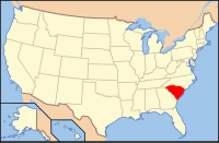
Lee County, South Carolina
| Lee County, South Carolina | |
|---|---|

Lee County Courthouse
|
|
 Location in the U.S. state of South Carolina |
|
 South Carolina's location in the U.S. |
|
| Founded | 1902 |
| Seat | Bishopville |
| Largest city | Bishopville |
| Area | |
| • Total | 411 sq mi (1,064 km2) |
| • Land | 410 sq mi (1,062 km2) |
| • Water | 1.0 sq mi (3 km2), 0.3% |
| Population (est.) | |
| • (2015) | 17,896 |
| • Density | 47/sq mi (18/km²) |
| Congressional district | 5th |
| Time zone | Eastern: UTC-5/-4 |
| Website | www |
Lee County is a county located in the U.S. state of South Carolina. As of the 2010 census, its population was 19,220, making it the fifth-least populous county in South Carolina. Its county seat is Bishopville. The county is named for Confederate General Robert E. Lee. A previous incarnation of Lee County was established in 1898 and disestablished in the next year; the current Lee County was formed in 1902.
According to the U.S. Census Bureau, the county has a total area of 411 square miles (1,060 km2), of which 410 square miles (1,100 km2) is land and 1.0 square mile (2.6 km2) (0.3%) is water.
As of the census of 2000, there were 20,119 people, 6,886 households, and 4,916 families residing in the county. The population density was 49 people per square mile (19/km²). There were 7,670 housing units at an average density of 19 per square mile (7/km²). The racial makeup of the county was 63.56% Black or African American, 35.03% White, 0.13% Native American, 0.19% Asian, 0.59% from other races, and 0.49% from two or more races. 1.31% of the population were Hispanic or Latino of any race.
There were 6,886 households out of which 32.70% had children under the age of 18 living with them, 43.00% were married couples living together, 23.80% had a female householder with no husband present, and 28.60% were non-families. 25.90% of all households were made up of individuals and 10.60% had someone living alone who was 65 years of age or older. The average household size was 2.68 and the average family size was 3.23.
...
Wikipedia
