Ledgeview, Wisconsin
| Ledgeview, Wisconsin | |
|---|---|
| Town | |

Town Hall and Fire Department Sign
|
|
| Motto: "Set Your Sights High" | |
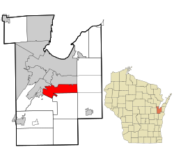
 Location in Brown County and the state of Wisconsin |
|
| Coordinates: 44°25′26″N 87°59′10″W / 44.42389°N 87.98611°WCoordinates: 44°25′26″N 87°59′10″W / 44.42389°N 87.98611°W | |
| Country | United States |
| State | Wisconsin |
| County | Brown |
| Area | |
| • Total | 17.5 sq mi (45.4 km2) |
| • Land | 17.4 sq mi (45.0 km2) |
| • Water | 0.2 sq mi (0.4 km2) |
| Elevation | 748 ft (228 m) |
| Population (2010) | |
| • Total | 6,555 |
| • Density | 377/sq mi (145.6/km2) |
| Time zone | Central (CST) (UTC-6) |
| • Summer (DST) | CDT (UTC-5) |
| Area code(s) | 920 |
| FIPS code | 55-43090 |
| GNIS feature ID | 1729678 |
| Website | ledgeviewwisconsin |
Ledgeview is a town in Brown County in the U.S. state of Wisconsin. The population was 6,555 as of the 2010 census, up from 3,363 at the 2000 census. The unincorporated communities of Kolb and Pine Grove are located in the town.
The Town of Ledgeview was originally the "Town of De Pere" until the town changed the name stop confusion with the city of De Pere. The town at first wrote the city fathers of De Pere to see if they would change their name, as the town of De Pere was older than the city. The city of De Pere refused.
The Town of Ledgeview is located just south of the center of Brown County. It is bordered by the city of De Pere to the west, the village of Bellevue to the north, the Town of Eaton to the east, the Town of Glenmore to the south, and the Town of Rockland to the southwest. Downtown Green Bay is 7 miles (11 km) to the north.
According to the United States Census Bureau, the Town of Ledgeview has a total area of 17.5 square miles (45.4 km2), of which 17.4 square miles (45.0 km2) is land and 0.15 square miles (0.4 km2), or 0.81%, is water.
As of the census of 2000, there were 3,363 people, 1,180 households, and 913 families residing in the town. The population density was 190.9 people per square mile (73.7/km²). There were 1,214 housing units at an average density of 68.9 per square mile (26.6/km²). The racial makeup of the town was 98.69% White, 0.21% African American, 0.18% Native American, 0.39% Asian, 0.21% from other races, and 0.33% from two or more races. Hispanic or Latino of any race were 0.74% of the population.
...
Wikipedia
