Lebanon Municipal Airport (New Hampshire)
| Lebanon Municipal Airport | |||||||||||||||
|---|---|---|---|---|---|---|---|---|---|---|---|---|---|---|---|

Approach to Runway 18, July 2007
|
|||||||||||||||
| Summary | |||||||||||||||
| Airport type | Public | ||||||||||||||
| Owner | City of Lebanon | ||||||||||||||
| Serves | Lebanon, New Hampshire | ||||||||||||||
| Elevation AMSL | 603 ft / 184 m | ||||||||||||||
| Coordinates | 43°37′34″N 072°18′15″W / 43.62611°N 72.30417°WCoordinates: 43°37′34″N 072°18′15″W / 43.62611°N 72.30417°W | ||||||||||||||
| Website | fly |
||||||||||||||
| Map | |||||||||||||||
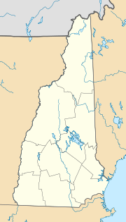
| Location of airport in New Hampshire/United States | |||||||||||||||
| Runways | |||||||||||||||
|
|||||||||||||||
| Statistics (2015) | |||||||||||||||
|
|||||||||||||||
|
Source: Federal Aviation Administration
|
|||||||||||||||
| Aircraft operations | 30,221 |
|---|---|
| Based aircraft | 41 |
Lebanon Municipal Airport (IATA: LEB, ICAO: KLEB, FAA LID: LEB) is a city owned, public use airport located three nautical miles (6 km) west of the central business district of Lebanon, a city in Grafton County, New Hampshire, United States. Also known as Lebanon Airport, it is the northernmost commercial airport in New Hampshire, near the Vermont border, off Interstate 89 just south of the junction with Interstate 91. Other nearby towns include Hanover, New Hampshire and White River Junction, Vermont. The area is also the home of Dartmouth College and the Dartmouth-Hitchcock Medical Center.
In recent years, the airport has struggled due to competition with the much larger Manchester-Boston Regional Airport, 65 miles (87 kilometers) away.Colgan Air formerly offered non-stop flights from Lebanon to New York-La Guardia Airport operating as US Airways Express. The airline first operated the flights with the Beechcraft 1900, and later with the Saab 340 before service ended in November 2008.
...
Wikipedia


