Lawrence, KS
| Lawrence, Kansas | ||
|---|---|---|
| City | ||

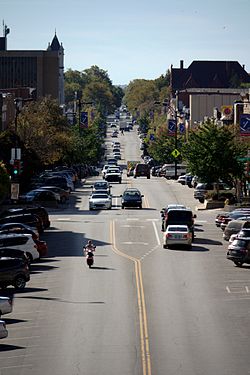
Massachusetts Street downtown
|
||
|
||
| Nickname(s): River City | ||
| Motto: From Ashes to Immortality | ||
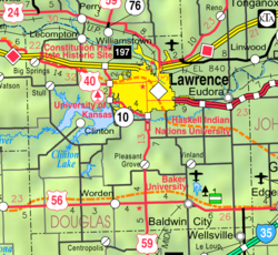
 Location within Douglas County and Kansas |
||
 KDOT map of Douglas County (legend) |
||
| Coordinates: 38°58′18″N 95°14′7″W / 38.97167°N 95.23528°WCoordinates: 38°58′18″N 95°14′7″W / 38.97167°N 95.23528°W | ||
| Country | United States | |
| State | Kansas | |
| County | Douglas | |
| Founded | 1854 | |
| Government | ||
| • Mayor | Leslie Soden | |
| • Vice Mayor | Stuart Boley | |
| • City Manager | Tom Markus | |
| Area | ||
| • Total | 34.26 sq mi (88.73 km2) | |
| • Land | 33.56 sq mi (86.92 km2) | |
| • Water | 0.70 sq mi (1.81 km2) | |
| Elevation | 866 ft (264 m) | |
| Population (2010) | ||
| • Total | 87,643 | |
| • Estimate (2015) | 93,917 | |
| • Density | 2,600/sq mi (990/km2) | |
| Time zone | CST (UTC-6) | |
| • Summer (DST) | CDT (UTC-5) | |
| ZIP code | 66044-66047, 66049 | |
| Area code | 785 | |
| FIPS code | 20-38900 | |
| GNIS ID | 0479145 | |
| Website | lawrenceks |
|
Lawrence is the sixth largest city in the state of Kansas and the county seat of Douglas County, Kansas. It is in northeastern Kansas next to Interstate 70, along the banks of the Kansas and Wakarusa Rivers. As of the 2010 census, the city's population was 87,643. Lawrence is a college town and the home to the University of Kansas and Haskell Indian Nations University.
Lawrence was founded by the New England Emigrant Aid Company and was named for Amos Adams Lawrence who offered financial aid and support for the settlement. Lawrence was central to the Bleeding Kansas era and was the site of the Wakarusa War, the sacking of Lawrence, and the Lawrence Massacre.
Lawrence began as a center of Kansas politics. However, its economy soon diversified into many industries including agriculture, manufacturing, and ultimately education, beginning with the founding of the University of Kansas in 1866, and later Haskell Indian Nations University in 1884.
Prior to Kansas Territory being opened to settlement in May 1854, most of Douglas County was part of the Shawnee Indian Reservation. The Oregon Trail followed the Kansas River through what would become Lawrence and Mount Oread was used as a landmark and an outlook.
...
Wikipedia

