Lat Phrao (district)
|
Lat Phrao ลาดพร้าว |
|
|---|---|
| Khet | |
 Khet location in Bangkok |
|
| Coordinates: 13°48′13″N 100°36′27″E / 13.80361°N 100.60750°ECoordinates: 13°48′13″N 100°36′27″E / 13.80361°N 100.60750°E | |
| Country | Thailand |
| Province | Bangkok |
| Seat | Lat Phrao |
| Khwaeng | 2 |
| Khet established | 4 September 1989 |
| Area | |
| • Total | 21.5 km2 (8.3 sq mi) |
| Population (2016) | |
| • Total | 121,000 |
| • Density | 5,627.90/km2 (14,576.2/sq mi) |
| Time zone | ICT (UTC+7) |
| Postal code | 10310 and 10230 |
| Geocode | 1038 |
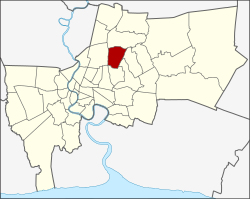
Lat Phrao (Thai: ลาดพร้าว; IPA: [lâːt pʰráːw]) is one of the 50 districts (Khet) of Bangkok, Thailand. The district is bounded by six other districts (from north clockwise): Bang Khen, Bueng Kum, Bang Kapi, Wang Thonglang, and Chatuchak.
Formerly, Lat Phrao was a tambon of amphoe Bang Kapi, in what was then Phra Nakhon Province, before the unification of Thonburi and Phra Nakhon into the single administrative area of Krung Thep (Bangkok). Later it was a sub-district (tambon) of the Bang Kapi District (amphoe), after naming conventions were changed for administrative districts of Bangkok.
On 4 September 1989, Lat Phrao was split off from Bang Kapi along with Bueng Kum as new districts.
In 1997, the boundaries of Lat Phrao District were modified to help balance the size and population of Bangkok's districts. The portion of Chorake Bua sub-district north of Khok Khram and Ta Reng canals was reassigned as part of Bang Khen District, and portions of the Lat Phrao sub-district were changed to Wang Thonglang District.
On 24 January 2002, portions of Wang Thonglang District were reassigned to Lat Phrao Sub-district.
The district is divided into two sub-districts (khwaeng).
...
Wikipedia
