Larkspur, Colorado
| Larkspur, Colorado | |
|---|---|
| Home Rule Municipality | |

Entering from the north
|
|
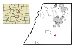
 Location in Douglas County and the state of Colorado |
|
| Coordinates: 39°13′38″N 104°53′3″W / 39.22722°N 104.88417°WCoordinates: 39°13′38″N 104°53′3″W / 39.22722°N 104.88417°W | |
| Country |
|
| State |
|
| County | Douglas County |
| Incorporated | 1979 |
| Government | |
| • Type | Home Rule Municipality |
| Area | |
| • Total | 1.5 sq mi (3.9 km2) |
| • Land | 1.5 sq mi (3.9 km2) |
| • Water | 0 sq mi (0 km2) |
| Elevation | 6,726 ft (2,050 m) |
| Population (2010) | |
| • Total | 183 |
| • Density | 122/sq mi (47.2/km2) |
| Time zone | MST (UTC-7) |
| • Summer (DST) | MDT (UTC-6) |
| ZIP code | 80118 |
| Area code(s) | Both 303 and 720 |
| FIPS code | 08-43550 |
| GNIS feature ID | 0193176 |
| Website | www |
Larkspur is a home rule municipality in Douglas County, Colorado, United States. The town population was 183 at the 2010 census, down from 234 at the 2000 census. Each year, on weekends in June and July, the Colorado Renaissance Festival is held in the hills just west of the town. The town is served by Larkspur Elementary School, a K-6 school in the Douglas County school district.
A post office called Larkspur has been in operation since 1871. The community was named for the abundance of larkspur near the original town site.
Larkspur is located in southern Douglas County at 39°13′38″N 104°53′03″W / 39.227091°N 104.884233°W, in the valley of East Plum Creek. Interstate 25 passes along the eastern edge of the town, with access from Exits 172, 173, and 174. I-25 leads north 11 miles (18 km) to Castle Rock, the Douglas County seat, and 39 miles (63 km) to Denver, as well as south 32 miles (51 km) to Colorado Springs.
According to the United States Census Bureau, the town has a total area of 1.5 square miles (3.9 km2), all land.
As of the census of 2000, there were 234 people, 92 households, and 59 families residing in the town. The population density was 173.5 per square mile (66.9/km²). There were 94 housing units at an average density of 69.7 per square mile (26.9/km²). The racial makeup of the town was 97.86% White, 0.85% Native American, and 1.28% from two or more races. Hispanic or Latino of any race were 1.71% of the population.
...
Wikipedia
