Lapwai, Idaho
| Lapwai, Idaho | |
|---|---|
| City | |
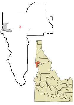
 Location of Lapwai, Idaho |
|
| Coordinates: 46°24′16″N 116°48′16″W / 46.40444°N 116.80444°WCoordinates: 46°24′16″N 116°48′16″W / 46.40444°N 116.80444°W | |
| Country | United States |
| State | Idaho |
| County | Nez Perce |
| Area | |
| • Total | 0.81 sq mi (2.10 km2) |
| • Land | 0.80 sq mi (2.07 km2) |
| • Water | 0.01 sq mi (0.03 km2) |
| Elevation | 955 ft (291 m) |
| Population (2010) | |
| • Total | 1,137 |
| • Estimate (2012) | 1,140 |
| • Density | 1,421.3/sq mi (548.8/km2) |
| Time zone | Pacific (PST) (UTC-8) |
| • Summer (DST) | PDT (UTC-7) |
| ZIP code | 83540 |
| Area code(s) | 208 |
| FIPS code | 16-45370 |
| GNIS feature ID | 0396768 |
| Website | cityoflapwai.com |
Lapwai is a city in Nez Perce County, Idaho, United States. Its population was 1,137 at the 2010 census, and it is the seat of government of the Nez Perce Indian Reservation.
The area that is today Lapwai was the home of Hin-ma-tute-ke-kaikt, also known as Big Thunder and later as James. It was here that Henry H. Spalding established a Protestant mission among the Nez Perce in 1836. This was also the general region that Bill Craig settled since his wife was James' daughter.
The city's predecessor, Fort Lapwai, operated on the site from 1863 to 1884. The village of Lapwai was incorporated in 1911, with a model rural school.
The word "Lapwai" means place of the butterflies, as the area had thousands in early summer in earlier years.
Lapwai is part of the Lewiston, ID-WA Metropolitan Statistical Area.
Lapwai is located at 46°24′16″N 116°48′16″W / 46.40444°N 116.80444°W (46.404388, -116.804376)., at an elevation of 955 feet (291 m) above sea level
According to the United States Census Bureau, the city has a total area of 0.81 square miles (2.10 km2), of which, 0.80 square miles (2.07 km2) is land and 0.01 square miles (0.03 km2) is water.
...
Wikipedia
