Landerd
| Landerd | |||
|---|---|---|---|
| Municipality | |||

Windmill in Reek
|
|||
|
|||
 Location in North Brabant |
|||
| Coordinates: 51°42′N 5°40′E / 51.700°N 5.667°ECoordinates: 51°42′N 5°40′E / 51.700°N 5.667°E | |||
| Country | Netherlands | ||
| Province | North Brabant | ||
| Established | 1 January 1994 | ||
| Government | |||
| • Body | Municipal council | ||
| • Mayor | Marnix Bakermans | ||
| Area | |||
| • Total | 70.71 km2 (27.30 sq mi) | ||
| • Land | 70.38 km2 (27.17 sq mi) | ||
| • Water | 0.33 km2 (0.13 sq mi) | ||
| Elevation | 20 m (70 ft) | ||
| Population (February 2017) | |||
| • Total | 15,295 | ||
| • Density | 217/km2 (560/sq mi) | ||
| • Uden-Veghel | 175,119 | ||
| Time zone | CET (UTC+1) | ||
| • Summer (DST) | CEST (UTC+2) | ||
| Postcode | 5374–5375, 5410–5411 | ||
| Area code | 0486 | ||
| Website | www |
||
Landerd (![]() pronunciation ) is a municipality within the province of North Brabant in the southern Netherlands.
pronunciation ) is a municipality within the province of North Brabant in the southern Netherlands.
Landerd is the result of a merger between the formerly independent municipalities of Schaijk and Zeeland on 1 January 1994. Schaijk and Reek had merged earlier on 1 July 1942.
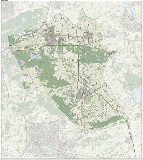
Dutch topographic map of the municipality of Landerd, June 2015
...
Wikipedia


