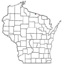
Land O' Lakes (town), Wisconsin
| Land O' Lakes, Wisconsin | |
|---|---|
| Town | |
 Location of Land O' Lakes, Wisconsin |
|
 2010 Town of Land O' Lakes map |
|
| Coordinates: 46°9′17″N 89°23′7″W / 46.15472°N 89.38528°WCoordinates: 46°9′17″N 89°23′7″W / 46.15472°N 89.38528°W | |
| Country | United States |
| State | Wisconsin |
| County | Vilas |
| Area | |
| • Total | 95.3 sq mi (246.8 km2) |
| • Land | 83.1 sq mi (215.2 km2) |
| • Water | 12.2 sq mi (31.7 km2) |
| Elevation | 1,755 ft (535 m) |
| Population (2010) | |
| • Total | 861 |
| • Density | 10.6/sq mi (4.1/km2) |
| Time zone | Central (CST) (UTC-6) |
| • Summer (DST) | CDT (UTC-5) |
| Area code(s) | 715 & 534 |
| FIPS code | 55-42325 |
| GNIS feature ID | 1583525 |
Land O' Lakes is a town in Vilas County, Wisconsin, United States. The population was 861 at the 2010 census. The unincorporated community of Land O' Lakes is located in the town.
On January 4, 1907, the Town of State Line was created. On April 28, 1948, the name of the town was changed to the Town of Land O' Lakes.
The Town of Land o' Lakes is located in north-central Vilas County along the border with the Upper Peninsula of Michigan. The headwaters of a branch of the Ontonagon River is located in the town at the Cisco Chain of lakes, and the upper part of the Wisconsin River flows through the town, with the headwaters being located just to the east at Lac Vieux Desert. According to the United States Census Bureau, the town has a total area of 95.3 square miles (246.9 km²) of which 83.1 square miles (215.2 km²) is land and 12.2 square miles (31.7 km²) (12.83%) is water. The town is very long and narrow, with the town center, government offices, and most services located in the unincorporated community of Land o' Lakes at the far eastern end of the town.
At the 2010 census, there were 861 people, 433 households and 264 families residing in the town. The population density was 10.6 per square mile (4.1/km²). There were 1,337 housing units at an average density of 16.1 per square mile (6.2/km²). The racial makeup of the town was 98.41% White, 0.68% Native American, 0.34% Asian, 0.45% from other races, and 0.11% from two or more races. Hispanic or Latino of any race were 0.45% of the population.
...
Wikipedia
