Lake Tekapo
| Lake Tekapo | |
|---|---|

Lake Tekapo
|
|

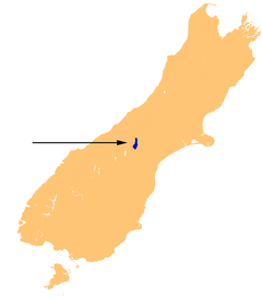
Location of Lake Tekapo.
|
|
| Location | Mackenzie District, Canterbury Region, South Island |
| Coordinates | 43°53′S 170°31′E / 43.883°S 170.517°ECoordinates: 43°53′S 170°31′E / 43.883°S 170.517°E |
| Primary inflows | Godley River (north), Macauley River (north), Mistake River (west), Cass River (west) |
| Primary outflows | Tekapo River |
| Catchment area | 1,463 km2 (565 sq mi) |
| Basin countries | New Zealand |
| Max. length | 27 km (17 mi) |
| Max. width | 6 km (3.7 mi) (max), 3.5 kilometres (2.2 mi) (mean) |
| Surface area | 87 km2 (34 sq mi) (summer), 82 km2 (32 sq mi) (winter), |
| Average depth | 69 m (226 ft) |
| Max. depth | 120 m (390 ft) |
| Water volume | 6 km3 (4.9×10⁶ acre·ft) |
| Surface elevation | 710 m (2,330 ft) |
| Settlements | Lake Tekapo |
| References | |
Lake Tekapo is the second-largest of three roughly parallel lakes running north–south along the northern edge of the Mackenzie Basin in the South Island of New Zealand (the others are Lake Pukaki and Lake Ohau). It covers an area of 83 square kilometres (32 sq mi), and is at an altitude of 710 metres (2,330 ft) above sea level.
The lake is fed at its northern end by the braided Godley River, which has its source in the Southern Alps to the north. The lake is a popular tourist destination, and several resort hotels are located at the township of Lake Tekapo at the lake's southern end. The Lake Tekapo Regional Park, administered by Environment Canterbury, is located on the southern shore of the lake.
An astronomical observatory is located at Mount John, which is to the north of the town, and south of the small Lake Alexandrina.
The lake's original outflow was at its southern end, into the Tekapo River. In 1938 construction commenced on a power station, originally due to be finished in 1943 but halted in 1942 by the world war. At the same time, control gates were constructed to regulate outflows to the Waitaki Dam downstream. Work restarted in 1944, and the power station now known as "Tekapo A" came online in 1951.
Water from the lake is diverted through a 1.4-kilometre (4,600 ft) tunnel under the town to the power station, with the water originally being returned to the river. With development of the Upper Waitaki hydroelectric scheme in the 1970s, water is now fed into a 26-kilometre (16 mi) canal which leads to Tekapo B on the shores of Lake Pukaki.
...
Wikipedia
