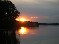
Lake Strom Thurmond
| Lake Strom Thurmond | |
|---|---|

Sunset
|
|
| Location | McCormick County, SC & Lincoln County, GA & Columbia County, GA |
| Coordinates | 33°39′40″N 082°11′57″W / 33.66111°N 82.19917°WCoordinates: 33°39′40″N 082°11′57″W / 33.66111°N 82.19917°W |
| Lake type | reservoir |
| Primary inflows | Savannah River |
| Primary outflows | Savannah River |
| Basin countries | United States |
| Surface area | 71,100 acres (288 km2) |
| Surface elevation | 330 ft (100 m) |
Lake Strom Thurmond, also known as Clarks Hill Lake, is a reservoir at the border between Georgia and South Carolina in the Savannah River Basin. It was created by the J. Strom Thurmond Dam during 1951 and 1952 by the U.S. Army Corps of Engineers near the confluence of the "Little River" and the Savannah River. At 71,000 acres (290 km2), it is the third-largest artificial lake east of the Mississippi River, behind the Kentucky Lake on the Tennessee River and Lake Marion on the Santee River. The J. Strom Thurmond Dam is located upstream from Augusta, Georgia.
The Thurmond Lake and Dam is one of the southeast's largest and most popular public recreation lakes. The dam Built by the U.S. Army Corps of Engineers between 1946 and 1954 but the lake was filled during 1951 and 1952 as part of a flood control, hydropower, and navigation project. Its legally authorized purposes now include recreation, water quality, water supply, and fish and wildlife management. Each year, millions of people utilize the many public parks, marinas, and campgrounds conveniently located around the lake to pursue a variety of outdoor recreational experiences -making Thurmond one of the 10 most visited Corps lakes in the nation.
Thurmond Lake is a man-made lake bordering Georgia and South Carolina on the Savannah, Broad, and Little Rivers. The lake is created by the J. Strom Thurmond Dam located on the Savannah River 22 miles (35 km) above Augusta Georgia and 239.5 miles (385.4 km) above the mouth of the Savannah River. The lake extends 39.4 miles (63.4 km) up the Savannah River, 29 miles (47 km) up the Little River in Georgia, and 6.5 miles (10.5 km) up the Broad River in Georgia, and 17 miles (27 km) up the Little River in South Carolina, at normal pool elevation of 330 mean sea level, Thurmond Lake comprises nearly 71,100 acres (287 km²) of water with a shoreline of 1,200 miles (1,900 km). The entire Thurmond “Project” contains 151,000 acres (611 km²) of land and water.
...
Wikipedia
