Lake Holcombe, Wisconsin
| Lake Holcombe, Wisconsin | |
|---|---|
| Town | |

Town Hall
|
|
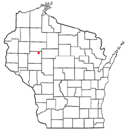
 Location of Lake Holcombe, Wisconsin |
|
| Coordinates: 45°14′52″N 91°6′7″W / 45.24778°N 91.10194°WCoordinates: 45°14′52″N 91°6′7″W / 45.24778°N 91.10194°W | |
| Country | United States |
| State | Wisconsin |
| County | Chippewa |
| Area | |
| • Total | 30.6 sq mi (79.3 km2) |
| • Land | 26.6 sq mi (69.0 km2) |
| • Water | 4.0 sq mi (10.4 km2) |
| Elevation | 1,056 ft (322 m) |
| Population (2010) | |
| • Total | 1,031 |
| • Density | 39/sq mi (14.9/km2) |
| Time zone | Central (CST) (UTC-6) |
| • Summer (DST) | CDT (UTC-5) |
| Area code(s) | 715 & 534 |
| FIPS code | 55-41550 |
| GNIS feature ID | 1583512 |
| PLSS township | Most of T32N R6W and a bit of T31N R6W |
Lake Holcombe is a town in Chippewa County in the U.S. state of Wisconsin. Its population was 1,031 at the 2010 census. The census-designated place of Holcombe is located in the town.
The area that would become Holcombe was first surveyed in 1852 by crews working for the U.S. government. One crew marked all the section corners of the township, walking through the woods and wading the rivers, measuring with chain and compass. When done, the deputy surveyor filed this general description:
This Township contains a few(?) small Cedar & Tamarac Swamp, All unfit for cultivation. The surface is generally level, soil second rate and most of (?) fit for cultivation. The Township is covered with timber mostly Pine, Hemlock, Tamarac, Cedar and some Sugar Birch and Maple. The Chippewa River runs in a southerly direction through the west part of the Township and Fisher River runs through the South East part Both of the streams have a rapid current and furnish good motive power for Mills.
Originally called Little Falls in the 1870s, the community was established by the Union Lumbering Company along the Chippewa River and came to be known as Holcombe years later.
The original Little Falls dam was built in 1878 by Elijah Swift and Joseph Viles for the Chippewa River Improvement and Log Driving Company. It was big for the time, a wooden dam 625 feet (191 m) wide and 16 feet (4.9 m) high with 32 floodgates. Its main aim was to provide reliable water for floating logs downstream, even when natural water levels were low. With its gates wide open it could raise the Chippewa 3 feet (0.91 m), 100 miles (160 km) downstream. Parts of the dam were washed out by floods in 1880 and 1884. After the second washout, a dam-building specialist named Billy "the Beaver" England was brought in. He and his crew rebuilt the dam in the winter of 1884-1885, and it survived the floods for many years after. The journal of the dam's keeper from 1882 to 1890 still survives, briefly describing log drives and jams and the flood of 1884. A terrible accident occurred in 1905, when eleven log drivers drowned trying to get to a log jam near the dam. The dam functioned until 1910, when logging operations ceased. It washed out in the 1920s.
...
Wikipedia
