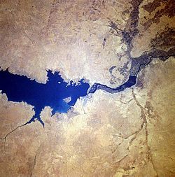
Lake Assad
| Lake Assad بحيرة الأسد |
|
|---|---|

|
|

Map of the wider Lake Assad region
|
|
| Location | Ar-Raqqah Governorate |
| Coordinates | 36°00′N 38°10′E / 36.000°N 38.167°ECoordinates: 36°00′N 38°10′E / 36.000°N 38.167°E |
| Type | reservoir |
| Primary inflows | Euphrates |
| Primary outflows | Euphrates |
| Basin countries | Syria, Turkey |
| Built | 1968 |
| First flooded | 1974 |
| Max. length | 80 km (50 mi) |
| Max. width | 8 km (5 mi) |
| Surface area | 525 km2 (203 sq mi) |
| Water volume | 10 km3 (2.4 cu mi) |
| Islands | Jazirat al-Thawrah |
| Settlements | Al-Thawrah |
Lake Assad (Arabic: بحيرة الأسد, Buhayrat al-Assad) is a reservoir on the Euphrates in Ar-Raqqah Governorate, Syria. It was created in 1974 when the Tabqa Dam was closed. Lake Assad is Syria’s largest lake with a maximum capacity of 11.7 cubic kilometres (2.8 cu mi) and a maximum surface area of 610 square kilometres (240 sq mi). A vast network of canals uses water from Lake Assad to irrigate lands on both sides of the Euphrates. In addition, the lake provides drinking water for the city of Aleppo and supports a fishing industry. The shores of Lake Assad have developed into important ecological zones.
The first plans for a dam in the Syrian part of the Euphrates date to 1927, but these were not carried out. In 1957, an agreement was reached with the Soviet Union for technical and financial aid for the construction of a dam in the Euphrates, and in 1960 a financial agreement was signed with West Germany. Another agreement to finance the project was signed with the Soviet Union in 1965. The project included a hydroelectric power station in the Tabqa Dam, and the construction of a vast irrigation network capable of irrigating 640,000 hectares (2,500 sq mi) of land on both sides of the Euphrates. Construction of the dam lasted between 1968 and 1973 and the flooding of the reservoir commenced in 1974 by reducing the flow of the Euphrates. In 1975, Iraq complained that the flow of the Euphrates had been reduced below an acceptable level and threatened to bomb the Tabqa Dam; mediation by Saudi Arabia and the Soviet Union eventually settled this dispute.
In anticipation of the flooding of the Tabqa Dam reservoir, an intensive, international program of archaeological rescue excavations was carried out in the threatened area between 1963 and 1974. As part of this program, excavations have been carried out at sites ranging in date from the Late Natufian to the Ottoman period. Excavated sites include Tell Abu Hureyra, Emar, Habuba Kabira, Mureybet, Tell es-Sweyhat, Tell Fray and Dibsi Faraj. At Qal'at Ja'bar, a castle on a hilltop that would be turned into an island by the flooding of Lake Assad, a protective glacis was built and two minarets at Mureybet and Meskene were relocated to an area beyond the flood zone.
...
Wikipedia
