Lajas, Puerto Rico
| Lajas, Puerto Rico | ||
|---|---|---|
| Municipality | ||
|
||
| Nickname(s): "La Ciudad Cardenalicia", "Los Tira Piedras" | ||
| Anthem: "Nuestro Lajas, pueblito querido" | ||
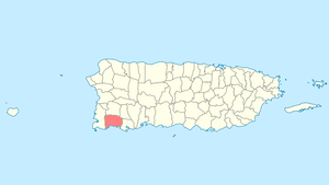
 Location of Lajas in Puerto Rico |
||
| Coordinates: 18°03′07″N 67°03′35″W / 18.05194°N 67.05972°WCoordinates: 18°03′07″N 67°03′35″W / 18.05194°N 67.05972°W | ||
| Country | United States | |
| Territory | Puerto Rico | |
| Founded | 1883 | |
| Government | ||
| • Mayor | Hon. Marcos Irizarry (PPD) | |
| • Senatorial dist. | 5 - Ponce | |
| • Representative dist. | 21 | |
| Area | ||
| • Total | 76.85 sq mi (199.04 km2) | |
| • Land | 61 sq mi (158 km2) | |
| • Water | 15.85 sq mi (41.04 km2) | |
| Population (2010) | ||
| • Total | 25,753 | |
| • Density | 340/sq mi (130/km2) | |
| Demonym(s) | Lajeños | |
| Time zone | AST (UTC-4) | |
| Zip code | 00667 | |
Lajas (Spanish pronunciation: [ˈlaxas], Flagstones) is a municipality of Puerto Rico located in southwestern Puerto Rico, on the southern coast of the island, bordering the Caribbean Sea, south of San Germán and Sabana Grande; east of Cabo Rojo; and west of Guánica. Lajas is spread over 11 wards plus Lajas Pueblo (the downtown area and the administrative center of the city). It is part of the San Germán-Cabo Rojo Metropolitan Statistical Area.
Located at the Lajas Valley, the town was founded in 1883 by the Xueta Teodoro Jacome Pagan. Xuetes (Chuetas) were Majorcan Jews (Sephardi Catalan Jews). Some families changed their names from Jacome to the Castilian form Santiago (Saint James the greater). Jacome is the Mallorquin form of James (Ia'akov). Catalonian Jews from Majorca were part of the early settlers in the South of (Boriken) Puerto Rico. The village of La Parguera (founded in 1940 by Andrew Breedlove and fishermen from Guánica and Cabo Rojo) is a popular tourist destination to see the famous Bahía Fosforescente (Phosphoresent Bay) and its keys and islet's.
Laguna Cartagena National Wildlife Refuge is a national protected area.
...
Wikipedia

