Laguna, New Mexico
| Laguna, New Mexico | |
|---|---|
| Census-designated place | |

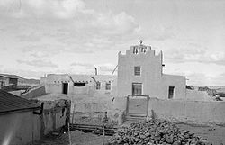
Laguna Mission, 1934. Photo: Historic American Buildings Survey
|
|
 Location of Laguna, New Mexico |
|
| Location in the United States | |
| Coordinates: 35°2′50″N 107°24′11″W / 35.04722°N 107.40306°WCoordinates: 35°2′50″N 107°24′11″W / 35.04722°N 107.40306°W | |
| Country | United States |
| State | New Mexico |
| County | Cibola |
| Area | |
| • Total | 10.9 sq mi (28.3 km2) |
| • Land | 10.9 sq mi (28.3 km2) |
| • Water | 0.0 sq mi (0.0 km2) |
| Elevation | 5,807 ft (1,770 m) |
| Population (2010) | |
| • Total | 1,241 |
| • Density | 113/sq mi (43.8/km2) |
| Time zone | Mountain (MST) (UTC-7) |
| • Summer (DST) | MDT (UTC-6) |
| ZIP code | 87026 |
| Area code(s) | 505 |
| FIPS code | 35-37070 |
| GNIS feature ID | 0928750 |
Laguna is a census-designated place (CDP) in Cibola County, New Mexico, United States. The population was 1,241 at the 2010 census. It is located west of Albuquerque.
Laguna was founded in 1699, making it the most recent of the New Mexican pueblos. The people of Laguna Pueblo speak Western Keresan. Laguna is home to an annual feast to Saint Joseph.
Laguna is located in eastern Cibola County at 35°2′50″N 107°24′11″W / 35.04722°N 107.40306°W (35.047195, -107.403024). It is bordered to the west by Paraje, to the southeast by Mesita, and to the south by Interstate 40, which provides access from Exit 114. Old U.S. Route 66 passes through the community.
According to the United States Census Bureau, the CDP has a total area of 10.9 square miles (28.3 km2), all of it land. The CDP includes the original settlement of Laguna as well as New Laguna, about 2.5 miles (4.0 km) to the west on old Highway 66.
As of the census of 2000, there were 423 people, 136 households, and 108 families residing in the CDP. The population density was 164.2 people per square mile (63.3/km²). There were 172 housing units at an average density of 66.8 per square mile (25.7/km²). The racial makeup of the CDP was 2.36% White, 96.45% Native American, 0.24% from other races, and 0.47% from two or more races. Hispanic or Latino of any race were 3.07% of the population.
...
Wikipedia

