Lady Isle
| Gaelic name | Eilean Mhoire |
|---|---|
| Location | |
|
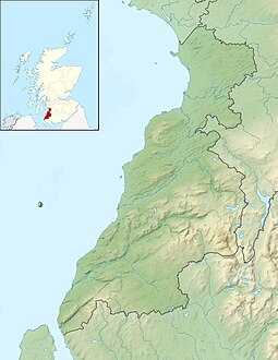
Lady Isle shown within South Ayrshire
|
|
| OS grid reference | NS27529335 |
| Coordinates | 55°32′N 4°44′W / 55.53°N 4.73°W |
| Physical geography | |
| Island group | Firth of Clyde |
| Area | 2.3 ha |
| Highest elevation | 6 m |
| Administration | |
| Sovereign state | United Kingdom |
| Country | Scotland |
| Council area | South Ayrshire |
| Demographics | |
| Population | 0 |

Lady Isle Lighthouse in 2009
|
|
|
Scotland
|
|
| Location | Lady Isle Troon Ayrshire Scotland United Kingdom |
|---|---|
| Coordinates | 55°31′38″N 4°44′02″W / 55.527180°N 4.733944°W |
| Year first constructed | 1903 |
| Construction | concrete tower |
| Tower shape | cylindrical tower with external spiral stairway |
| Markings / pattern | white tower and lantern, red vertical stripes |
| Height | 15 metres (49 ft) |
| Focal height | 19 metres (62 ft) |
| Light source | solar power |
| Range | 11 nautical miles (20 km; 13 mi) |
| Characteristic | Fl (4) W 30s |
| Admiralty number | A4562 |
| NGA number | 4744 |
| ARLHS number | SCO-117 |
| Managing agent | Northern Lighthouse Board |
|
[]
|
|
Lady Isle is a small, uninhabited island, in the Firth of Clyde, Scotland. It was once home to a chapel dedicated to Saint Mary. The island features a lighthouse and a freshwater spring.
Lady Isle lies some 2 miles [3.2 km] SW of Troon. The island is around 0.6 kilometres along its length and rises to a maximum height of just 6 metres. Half tide, Scart rocks and Seal rock are associated with Lady Isle. The island lies in the parish of Dundonald in South Ayrshire.
Timothy Pont's map of 1604 - 1608 published in 1654 by Joan Blaeu, marks Lady Isle by that name and indicates that a structure is present on the island, presumably the chapel. In c. 1636 - 1662 Robert Gordon's manuscript map marks the isle as 'Lady Yle' and shows two islands.John Adair in his 1686 A mape of the west of Scotland containing Clydsdail, Nithsdail, Ranfrew, Shyre of Ayre, & Galloway. shows Lady Isle as Mary Isle and indicates a chapel as being located on the island. In 1745 Moll used the name Lady Isle.
When Edward I of England came to Ayr in 1299 following the burning of the Barns of Ayr, Hermingford, an old chronicler of the period, records that:
It is thought that the name Isle of Ayr refers to Lady Isle.
The Geographical Collections relating to Scotland state:
Lady Isle is probably first mentioned in the title of William Fullarton of that Ilk, in his Charter under the Great Seal by William III, dated 9 December 1695, which included "the five pound land of Aldtoun containing the little isle, opposite the lands of Corsbie, called the Lady-isl".
The island came into the possession of William Fullarton in 1698 and was purchased by the Marquess of Titchfield in 1805. When the Marquess was elevated to become the Duke of Portland the island was part of the Duke's Fullarton Estate.
...
Wikipedia


