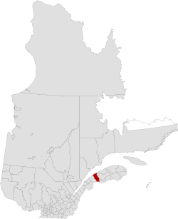
La Mitis
| La Mitis | |
|---|---|
| Regional county municipality | |
 |
|
| Coordinates: 48°32′N 68°05′W / 48.53°N 68.08°WCoordinates: 48°32′N 68°05′W / 48.53°N 68.08°W | |
| Country |
|
| Province |
|
| Region | Bas-Saint-Laurent |
| Effective | January 1, 1982 |
| County seat | Mont-Joli |
| Government | |
| • Type | Prefecture |
| • Prefect | Michel Côté |
| Area | |
| • Total | 2,538.80 km2 (980.24 sq mi) |
| • Land | 2,279.22 km2 (880.01 sq mi) |
| Population (2011) | |
| • Total | 18,942 |
| • Density | 8.3/km2 (21/sq mi) |
| • Pop 2006–2011 |
|
| • Dwellings | 9,471 |
| Time zone | EST (UTC−5) |
| • Summer (DST) | EDT (UTC−4) |
| Area code(s) | 418 and 581 |
| Website | www |
La Mitis is a regional county municipality in the Bas-Saint-Laurent region in eastern Quebec, Canada on the Gaspé peninsula. It is named for the Mitis River (The Mitis) which has its source in the region (at Lac Inférieur) and flows through the central part of the region before emptying into the Saint Lawrence River.
The county seat is in Mont-Joli.
There are 18 subdivisions within the RCM:
Highways and numbered routes that run through the municipality, including external routes that start or finish at the county border:
...
Wikipedia
