Lüshunkou District
|
Lüshunkou 旅顺口区 |
||||||||||||||||||||||||||||||||||
|---|---|---|---|---|---|---|---|---|---|---|---|---|---|---|---|---|---|---|---|---|---|---|---|---|---|---|---|---|---|---|---|---|---|---|
| District | ||||||||||||||||||||||||||||||||||

View of Lüshun's harbor and town from an old Japanese fortification
|
||||||||||||||||||||||||||||||||||
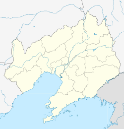
| Location in Liaoning | ||||||||||||||||||||||||||||||||||
| Coordinates: 38°51′12″N 121°15′01″E / 38.8534°N 121.2502°ECoordinates: 38°51′12″N 121°15′01″E / 38.8534°N 121.2502°E | ||||||||||||||||||||||||||||||||||
| Country |
|
|||||||||||||||||||||||||||||||||
| Province | Liaoning | |||||||||||||||||||||||||||||||||
| Sub-provincial city | Dalian | |||||||||||||||||||||||||||||||||
| Area | ||||||||||||||||||||||||||||||||||
| • Total | 512.15 km2 (197.74 sq mi) | |||||||||||||||||||||||||||||||||
| Population (2010) | ||||||||||||||||||||||||||||||||||
| • Total | 324,773 | |||||||||||||||||||||||||||||||||
| • Density | 630/km2 (1,600/sq mi) | |||||||||||||||||||||||||||||||||
| Time zone | China Standard (UTC+8) | |||||||||||||||||||||||||||||||||
| Dalian district map |
|
|||||||||||||||||||||||||||||||||
| Division code | 210212 | |||||||||||||||||||||||||||||||||
| Website | dllsk |
|||||||||||||||||||||||||||||||||
Lüshunkou District, Lyushunkou District, or Lvshunkou District (simplified Chinese: 旅顺口区; traditional Chinese: 旅順口區; pinyin: Lǚshùnkǒu Qū) is one of the seven districts of Dalian, Liaoning province, China. Also called Lüshun City (旅顺市; 旅順市; Lǚshùn Shì) or (more literally) Lüshun Port (旅顺港; 旅順港; Lǚshùn gǎng), it was formerly known as both Port Arthur (亚瑟港; 亞瑟港; Yàsè Gǎng; Russian: Порт-Артур; Port-Artur) and Ryojun (Japanese: 旅順). Its area is 512.15 square kilometres (197.74 sq mi) and its permanent population as of 2010[update] is 324,773.
Lüshunkou is located at the extreme southern tip of the Liaodong Peninsula. It has an excellent natural harbour, the possession and control of which became a casus belli of the Russo-Japanese War (1904–05). Japanese and then Soviet administration continued until 1953. During the first decade of that period, it was world-famous and was more significant than the other port on the peninsula, Dalian proper. In Western diplomatic, news, and historical writings, it was known as Port Arthur, and during the period when the Japanese controlled and administered the Liaodong (formerly Liaotung) Peninsula it was called Ryojun (旅順), the Japanese pronunciation of the Chinese characters in the city's name.
...
Wikipedia


