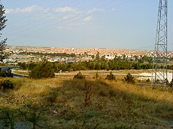
Lüleburgaz
| Lüleburgaz | |
|---|---|
 |
|
| Coordinates: 41°24′20″N 27°21′25″E / 41.40556°N 27.35694°ECoordinates: 41°24′20″N 27°21′25″E / 41.40556°N 27.35694°E | |
| Country | Turkey |
| Province | Kırklareli |
| Government | |
| • Mayor | Emin Halebak (CHP) |
| • Kaymakam | Lütfullah Gürsöy |
| Area | |
| • District | 1,017.79 km2 (392.97 sq mi) |
| Elevation | 30 m (100 ft) |
| Population (2012) | |
| • Urban | 105,279 |
| • District | 137,872 |
| • District density | 140/km2 (350/sq mi) |
| Climate | Csa |
| Website |
www www |
Lüleburgaz, (Turkish: [lyˈlebuɾɡaz]; Bulgarian: Люлебургас, Lyuleburgas, or Беркулен, Berkulen; Greek: Αρκαδιούπολις/Αρκαδιούπολη, Arkadioupoli) is a town and district of Kırklareli Province in the Marmara region of Turkey.
The city has a population of 100,412 (2010 census) and is the largest district center in Kırklareli Province.
Lüleburgaz is known for its sixteenth-century mosque and bridge, both named after the Grand Vizier Sokollu Mehmet Paşa and purportedly designed by the Ottoman chief architect Mimar Sinan.
The economy of Lüleburgaz is mainly based on the industrial sector and agriculture. There are various factories around the city.
Widely grown crop in Lüleburgaz are sunflower, wheat and corn.
The ancient name of the city was Bergula; Emperor Theodosius I changed it to Arcadiopolis (Greek: Αρκαδιούπολις) in honour of his son and successor Arcadius.
The city of Arcadiopolis fell to Attila the Hun during his campaign against the Eastern Roman Empire in 443 AD.
The Battle of Arcadiopolis (970) saw Byzantine forces defeat an invading Kievan-Pecheneg-Magyar force who were aiming to capture Constantinople, 100 miles (161 kilometres) to the east.
...
Wikipedia

