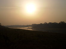
Kuwana River
| Rāptī Nadī | |
|---|---|
 |
|
| Native name | राप्ती नदी |
| Country | Nepal, India |
| Basin features | |
| Main source |
Rapti Zone, Nepal south of border of Rukum District with Rolpa District 3,500 m (11,500 ft) 28°28′33″N 82°52′44″E / 28.4757°N 82.8788°E |
| River mouth |
Ghaghara River 60 m (200 ft) 26°17′20″N 83°40′08″E / 26.289°N 83.669°ECoordinates: 26°17′20″N 83°40′08″E / 26.289°N 83.669°E |
| River system | Ganges |
| Basin size | 23,900 km2 (9,200 sq mi) |
| Tributaries |
|
| Physical characteristics | |
| Discharge |
|
West Rapti drains Rapti Zone in Mid-Western Region, Nepal, then Awadh and Purvanchal regions of Uttar Pradesh state, India before joining the Ghaghara -- a major left bank tributary of the Ganges known as the Karnali inside Nepal.
The West Rapti is notable for janajati ethnic groups – Kham Magar among its highland sources and then Tharu in Inner Terai Deukhuri Valley, for its irrigation and hydroelectric potential, and for recurrent floods that led to its nickname "Gorakhpur's Sorrow".
The Rapti rises south of a prominent E-W ridgeline midway between the western Dhaulagiri Himalaya and the Mahabharat Range. A 3,500 metres (11,500 ft) summit on this ridgeline marks a triple divide. North of the triple divide the Karnali and Gandaki basins are adjacent; south of it the Rapti and similar but smaller Babai River (Nepali: बबई नदी; Babaī Nadī) separate the two larger basins. After crossing into India, the Babai and Rapti separately join the Karnali's continuation called Ghaghara. The Ghaghara ultimately joins the Ganges.
The Rapti's headwaters descend south from rugged highlands populated by Kham Magar. The western tributary Mādī Kholā (Nepali: माडी खोला) rises in northwestern Rolpa and is joined by Lungrī Kholā (Nepali: लुङग्री खोला) draining northeastern Rolpa. The Mardi then crosses into Pyuthan. It is joined by east-flowing Arun Kholā (Nepali: अरुण खोला) at Devithān (Nepali: देवीथान) where it enters a gorge through the Mahabharat Range.
...
Wikipedia
