Kuty
| Kúty | |
| Village | |
|
A church in Kúty
|
|
| Country | Slovakia |
|---|---|
| Region | Trnava |
| District | Senica |
| Elevation | 156 m (512 ft) |
| Coordinates | 48°39′20″N 17°01′10″E / 48.65556°N 17.01944°ECoordinates: 48°39′20″N 17°01′10″E / 48.65556°N 17.01944°E |
| Area | 27.158 km2 (10.486 sq mi) |
| Population | 4,121 (2005-12-31) |
| Density | 152/km2 (394/sq mi) |
| First mentioned | 1468 |
| Postal code | 908 01 |
| Area code | +421-34 |
| Car plate | SE |
| Statistics: MOŠ/MIS | |
| Website: www.kuty.sk | |
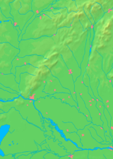
Kúty, (German: Kutti, Hungarian: Jókút) is a village and municipality in Senica District in the Trnava Region of western Slovakia.
In historical records the village was first mentioned in 1648.
The municipality lies at an altitude of 156 metres and covers an area of 27.158 km². It has a population of about 4,129 people.
Kúty is one of the most important railway junctions in Slovakia, a meeting point of four tracks. Being a railway border crossing, all trains travelling in the Prague-Bratislava railway corridor (including EuroCity trains) make a stopover in Kúty.
...
Wikipedia


