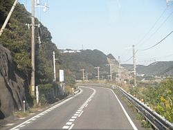
Kushimoto, Wakayama
|
Kushimoto 串本町 |
||
|---|---|---|
| Town | ||

Kushimoto Tahara
|
||
|
||
 Location of Kushimoto in Wakayama Prefecture |
||
| Location in Japan | ||
| Coordinates: 33°28′N 135°47′E / 33.467°N 135.783°ECoordinates: 33°28′N 135°47′E / 33.467°N 135.783°E | ||
| Country | Japan | |
| Region | Kansai | |
| Prefecture | Wakayama Prefecture | |
| District | Higashimuro | |
| Government | ||
| • Mayor | Katsumasa Tashima | |
| Area | ||
| • Total | 135.78 km2 (52.42 sq mi) | |
| Population (October 1, 2016) | ||
| • Total | 16,243 | |
| • Density | 120/km2 (310/sq mi) | |
| Symbols | ||
| • Tree | Tsubaki (Japanese Camellia) | |
| • Flower | Mochinoki (Birdlime Holly) | |
| Time zone | Japan Standard Time (UTC+9) | |
| Website | www |
|
Kushimoto (串本町 Kushimoto-chō?) is a coastal town located in Higashimuro District, Wakayama Prefecture in western Japan. The town has the distinction of being the southernmost point of Japan's main island, Honshū. The central area of town is on a narrow isthmus, surrounded on both sides by the Pacific Ocean. Kushimoto is bordered by the towns of Susami on the west, Kozagawa on the north, and Nachi-Katsuura on the east.
On April 1, 2005 Kushimoto absorbed the town of Koza, from Higashimuro District, to become the new town of Kushimoto.
The former town of Kushimoto was part of Nishimuro District, but the town has strong ties with the city of Shingū and Higashimuro District, both for political and economic reasons. The town became part of Higashimuro District upon this merger.
Though people were known to have inhabited the area since the Asuka Period, the first known documented settlements were established during the Edo Period. During that time, most of the area that encompasses Wakayama Prefecture today was known as Kii-no-Kuni (Kii Province) or Kishū. The area was owned by the Kii branch of the Tokugawa clan, headquartered at Wakayama Castle.
...
Wikipedia


