Kunduz Airport
| Kunduz Airport | |||||||||||
|---|---|---|---|---|---|---|---|---|---|---|---|
| Summary | |||||||||||
| Airport type | Public | ||||||||||
| Owner |
|
||||||||||
| Operator |
Afghan Ministry of Transport and Civil Aviation Afghan Ministry of Defense |
||||||||||
| Location | Kunduz, Afghanistan | ||||||||||
| Elevation AMSL | 1,457 ft / 444 m | ||||||||||
| Coordinates | 36°39′54″N 68°54′39″E / 36.66500°N 68.91083°ECoordinates: 36°39′54″N 68°54′39″E / 36.66500°N 68.91083°E | ||||||||||
| Map | |||||||||||
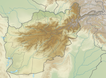
| Location of airport in Afghanistan | |||||||||||
| Runways | |||||||||||
|
|||||||||||
|
Sources: Ministry of Transport & Civil Aviation of Afghanistan, worldaerodata.com, Great Circle Mapper, Landings.com, AIP Afghanistan
|
|||||||||||
Kunduz Airport (IATA: UND, ICAO: OAUZ) is a public and military airport located 5 miles (8 km) south-southeast of Kunduz (also spelled Konduz), a city in Kunduz Province in Afghanistan. It is also 9 miles (14 km) west of Khan Abad, 25 miles (40 km) south of the Oxus River, and 33 miles (53 km) south of the Tajikistan border.
The airport is operated by the Afghan Ministry of Transport and Civil Aviation. It also used by the Afghan Ministry of Defense and the Resolute Support Mission.
Passenger
The airport resides at an elevation of 1,457 feet (444 m) above mean sea level. It has one runway designated 11/29 with an asphalt surface measuring 6,550 by 148 feet (1,996 m × 45 m). A new terminal was added to the airport in 2017, which has a capacity of 1,300 passengers. The entire airport is being expanded.
...
Wikipedia

