Kuandian Manchu Autonomous County
|
Kuandian County 宽甸县 ᡴᡠᠸᠠᠨᡩᡳᠶᠠᠨ ᠰᡳᠶᠠᠨ |
|
|---|---|
| Autonomous county | |
|
宽甸满族自治县
Kuandian ManchuAutonomous County |
|
 Location in Dandong City |
|
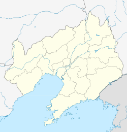
| Location of the county seat in Liaoning | |
| Coordinates: 40°44′N 124°47′E / 40.733°N 124.783°ECoordinates: 40°44′N 124°47′E / 40.733°N 124.783°E | |
| Country | People's Republic of China |
| Province | Liaoning |
| Prefecture-level city | Dandong |
| County seat | Kuandian Town (宽甸镇) |
| Area | |
| • Total | 6,193.7 km2 (2,391.4 sq mi) |
| Elevation | 284 m (932 ft) |
| Population | |
| • Total | 434,000 |
| • Density | 70/km2 (180/sq mi) |
| Time zone | China Standard (UTC+8) |
| Postal code | 118200 |
Kuandian Manchu Autonomous County (simplified Chinese: 宽甸满族自治县; traditional Chinese: 寬甸滿族自治縣; pinyin: Kuāndiàn Mǎnzú Zìzhìxiàn; Manchu: ᡴᡠᠸᠠᠨᡩᡳᠶᠠᠨ
ᠮᠠᠨᠵᡠ
ᠪᡝᠶᡝ
ᡩᠠᠰᠠᠩᡤᠠ
ᠰᡳᠶᠠᠨ), is a county of eastern Liaoning province, People's Republic of China, bordering North Korea to the southeast and Jilin in the northeast. It is under the administration of Dandong City, the centre of which lies 75 kilometres (47 mi) to the southwest, and is served by China National Highway 201. In Kuandian is the Hushan Great Wall, the most easterly section of the Great Wall of China. A short reconstruction of the wall is open to tourists. The area has an abandoned airstrip that was used by the Chinese airforce during the Korean War.
There are 19 towns, 2 townships and 1 ethnic township in the county.
Towns:
Townships:
Kuandian occupies the eastern half of Dandong City and is situated among the Changbai Mountains, on the northwest (right) bank of middle-lower reaches of the Yalu River, across which it borders the North Korean provinces of North Pyongan and Chagang. Domestically, it borders Ji'an (Jilin) to the northeast, Fengcheng to the west, Benxi to the northwest, and Huanren County to the north. It has a total area of 6,193.7 km2 (2,391.4 sq mi) and 216.5 km (134.5 mi) of the Sino-Korean border.
...
Wikipedia

