Kretinga district
|
Kretinga District Municipality Kretingos rajono savivaldybė |
||
|---|---|---|
| Municipality | ||

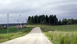
Landscape near Rūdaičiai
|
||
|
||
 Location of Kretinga district municipality within Lithuania |
||
| Coordinates: 55°53′00″N 21°23′00″E / 55.8833°N 21.3833°ECoordinates: 55°53′00″N 21°23′00″E / 55.8833°N 21.3833°E | ||
| Country |
|
|
| Ethnographic region | Samogitia | |
| County |
|
|
| Capital | Kretinga | |
| Elderships | 8 | |
| Area | ||
| • Total | 989 km2 (382 sq mi) | |
| Area rank | 39th | |
| Population (2001 census) | ||
| • Total | 45,700 | |
| • Rank | 22nd | |
| • Density | 46/km2 (120/sq mi) | |
| • Density rank | 15th | |
| Time zone | EET (UTC+2) | |
| • Summer (DST) | EEST (UTC+3) | |
| Telephone code | 445 | |
| Major settlements | ||
| Website | www |
|
Kretinga District Municipality is one of 60 municipalities in Lithuania.
...
Wikipedia

