Kreileroord
| Kreileroord | |
|---|---|
| Town | |
 |
|
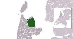
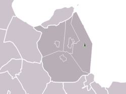
 The town centre (darkgreen) and the statistical district (lightgreen) of Kreileroord in the former municipality of Wieringermeer. |
|
| Coordinates: 52°50′32″N 5°4′53″E / 52.84222°N 5.08139°ECoordinates: 52°50′32″N 5°4′53″E / 52.84222°N 5.08139°E | |
| Country | Netherlands |
| Province | North Holland |
| Municipality | Hollands Kroon |
| Population (2007) | |
| • Total | 553 |
| Time zone | CET (UTC+1) |
| • Summer (DST) | CEST (UTC+2) |
Kreileroord is a town in the Dutch province of North Holland. It is a part of the municipality of Hollands Kroon, and lies about 21 km north of Hoorn.
In 2001, the town of Kreileroord had 608 inhabitants. The built-up area of the town was 0.14 km², and contained 229 residences.
...
Wikipedia
