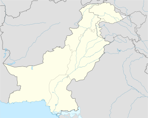
Kot Ghulam Muhammad
|
Kot Ghulam Muhammad Bhurgri ڪوٽ غلام محمد ڀرڳڙئ |
|
|---|---|
| Location in Sindh | |
| Coordinates: 25°17′14″N 69°15′7″E / 25.28722°N 69.25194°ECoordinates: 25°17′14″N 69°15′7″E / 25.28722°N 69.25194°E | |
| Country | Pakistan |
| Region | Mirpurkhas |
| Area | |
| • City | 192,296 km2 (74,246 sq mi) |
| • Urban | 3 km2 (1 sq mi) |
| Population | |
| • City | 180,000 approximately |
| • Urban | 80,000 approximately |
| • Rural | 100,000 approximately |
| Time zone | GMT + 5:00 PST |
| Area code(s) | 92(0233) |
Kot Ghulam Muhammad Bhurgri (Sindhi: ڪوٽ غلام محمد) (formerly known as Jemesabad) is named after Ghulam Muhammad Khan Bhurgri, the town situated in south-east Mirpur Khas District of the Southern Province Sindh in Pakistan. Kot Ghlam Muhammad Bhurgri is situated west of Samaro and north of Digri. It is about 45 kilometres (28 mi) south of Mirpur Khas.
Kot Ghulam Muhammad Bhurgari was formerly known as Jamesabad, it was named after Captain James Outram for his services in the Battle of Miani in Hyderabad. During British rule the town was renamed as Jamesabad earlier called Samaro
The taluka of Jamesabad was part of the Bombay Presidency, lying between 24°50' and 25°28' N. and 69°14' and 69°35′E and had an area of 505 square miles (1,310 km2). According to the 1901 census the population was 24,038 - an increase almost 5,000 since the 1891 (19,208). The density of 48 persons per square mile was considerably above the District average. The Taluka contained 184 villages, of which Jamesabad was headquarters. The land revenue and cesses 1903-4 amounted to 370,000.
The taluka has been renamed as Kot Ghulam Muhammad Bhurgari officially by Government of Sindh after Ghulam Muhammad Khan Bhurgari.
Ghulam Muhammad Khan Bhurgri is enlisted in Pioneers of Freedom for Pakistan. and was close friend to Mohammad Ali Jinnah the founder of Pakistan.
...
Wikipedia

