Knapdale
| Knapdale | |
|---|---|
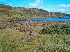
 Loch Arail |
|
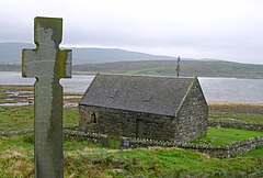
 Keills Chapel with cross |
|
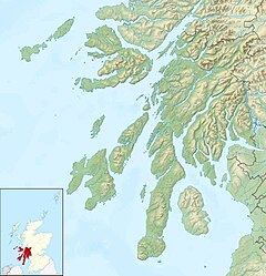
| Knapdale shown within Argyll and Bute | |
| Population | 2,325 |
| OS grid reference | NR700747 |
| • London | 370 mi (600 km) |
| Council area |
|
| Lieutenancy area |
|
| Country | Scotland |
| Sovereign state | United Kingdom |
| EU Parliament | Scotland |
| UK Parliament | |
| Scottish Parliament | |
| Website | knapdalepeople.com |
Knapdale (Scottish Gaelic: Cnapadal) forms a rural district of Argyll and Bute in the Scottish Highlands, adjoining Kintyre to the south, and divided from the rest of Argyll to the north by the Crinan Canal. It includes two parishes, North Knapdale and South Knapdale.
Knapdale Forest, planted in the 1930s, covers much of the region. During the 1930s, the Ministry of Labour supplied the men from among the unemployed, many coming from the crisis-hit mining and heavy industry communities of the Central Belt. They were housed in one of a number of Instructional Centres created by the Ministry, most of them on Forestry Commission property; by 1938, the Ministry had 38 Instructional Centres across Britain. The camp was used to hold enemy prisoners during the Second World War. The hutted camp in Knapdale was located at Cairnbaan, just south of the Crinan Canal, and a surviving building remains in use as a Forestry Commission workshop.
Local attractions include the Chapel of Keills. A grave-slab in the chapel has a carving of a clarsach similar to the Queen Mary Harp currently at the Museum of Scotland in Edinburgh, one of only three surviving medieval gaelic harps. West Highland grave slabs from the Argyll area suggest that Knapdale is where this harp originated. The village also has the thirteenth-century Kilmory Chapel and the late twelfth-century Castle Sween.
...
Wikipedia

