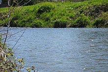
Kishwaukee River
| Kishwaukee River | |
|---|---|

Kishwaukee River in DeKalb, Illinois, May 2006
|
|
| Country | United States |
| Basin features | |
| Main source | Cropsey Moraine and 42°17′45″N 88°26′52″W / 42.29583°N 88.44778°W |
| River mouth |
Rock River 682 ft (208 m) 42°11′10″N 89°07′52″W / 42.18611°N 89.13111°WCoordinates: 42°11′10″N 89°07′52″W / 42.18611°N 89.13111°W |
| Basin size | 1257 sq mi |
| Physical characteristics | |
| Length | 63.4 mi (102.0 km) |
The Kishwaukee River, locally known as simply "The Kish", is a 63.4-mile-long (102.0 km) river in the U.S. state of Illinois.
The Kishwaukee River flows from to Rockford, Illinois where it is a tributary to the Rock River. The river begins as a small wetland stream off Route 47, just south of the Route 14 intersection in Woodstock. It meanders across northern Illinois to the Rock River, south of Rockford. This part of the river is known as the North Branch or the Main Branch. This stretch of stream has an average width of 50 feet (15 m) but where the river flows past the Boone County line it becomes both wider and deeper.
The South Branch of the Kishwaukee River originates high upon the Cropsey Moraine, just north of Shabbona. The river flows north to Genoa where it then turns westward and then flows north-northwest and joins the North Branch near Cherry Valley. The South Branch cuts across moraines and part of the river bed is the plain of an ancient lake. The South Branch's average width is 55 feet (17 m).
The Kishwaukee River drains land in southern Wisconsin and northern Illinois. In Illinois its watershed includes McHenry, Boone, Kane, DeKalb, Ogle, and Winnebago Counties. The entire watershed includes 1,257 square miles (3,256 km2) of land, which includes farmlands, prairies, savanna, wetlands, sloughs and forests. However the vast majority of the Kishwaukee watershed is agricultural in use. Crop lands occupy a full two thirds of the watershed's surface area.
...
Wikipedia
