Kirrawee, New South Wales
|
Kirrawee Sydney, New South Wales |
|||||||||||||
|---|---|---|---|---|---|---|---|---|---|---|---|---|---|

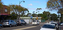
Oak Road, Kirrawee
|
|||||||||||||
| Coordinates | 34°2′5″S 151°4′16″E / 34.03472°S 151.07111°ECoordinates: 34°2′5″S 151°4′16″E / 34.03472°S 151.07111°E | ||||||||||||
| Population | 10,098 (2011 census) | ||||||||||||
| • Density | 2,404/km2 (6,230/sq mi) | ||||||||||||
| Established | 1939 | ||||||||||||
| Postcode(s) | 2232 | ||||||||||||
| Area | 4.2 km2 (1.6 sq mi) | ||||||||||||
| Location | 25 km (16 mi) south of Sydney CBD | ||||||||||||
| LGA(s) | Sutherland Shire | ||||||||||||
| State electorate(s) | |||||||||||||
| Federal Division(s) | Hughes | ||||||||||||
|
|||||||||||||
Kirrawee is a suburb in southern Sydney, in the state of New South Wales, Australia. Kirrawee is located 25 kilometres south of the Sydney central business district in the Sutherland Shire. Kirrawee lies between Sutherland, to the west, and Gymea and Grays Point, to the east. Kirrawee's southern border is formed by The Royal National Park, while Kareela and Jannali form the northern border.
Kirrawee is split between commercial and residential areas. Approximately 50% of the area to the north of the train line is occupied by commercial and industrial properties, while almost all of the area south of the train line is residential. South Kirrawee, which extends from the train line in the north to the Royal National Park in the south, has many houses on quiet roads with beautiful bush outlooks. North Kirrawee is predominantly a commercial/industrial zone containing small to medium-sized factories housing local businesses. It is also home to a number of petrol stations, car dealerships and a fast food chain outlet. However, the most northerly and western sections of this part of Kirrawee are residential, with some parts also with bush outlooks.
The Sutherland Shire Council website suggests two possible origins for the name, "Kirrawee". The first possibility is that it derives from an Aboriginal word meaning 'lengthy'; the second is that it derives from a Dharawal word, "gi(a)rrawee(i)" (alternative spelling "garrawi"), which means 'place of white cockatoos' or 'sulphur-crested cockatoos'. The current signage erected by the Council uses 'place of white cockatoos' as the accepted meaning for the suburb name. The name was adopted in 1939 with the opening of the Sutherland-Cronulla railway line. A postal receiving office in the locality was known as 'Bladesville'. It operated from the home of Mrs Louisa Blade, was opened in 1909 and closed in 1915 when a letter delivery service commenced from the post office at Sutherland.
...
Wikipedia

