Kinnelon, New Jersey
| Kinnelon, New Jersey | |
|---|---|
| Borough | |
| Borough of Kinnelon | |
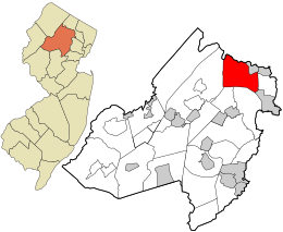
 Location in Morris County and the state of New Jersey. |
|
 Census Bureau map of Kinnelon, New Jersey |
|
| Coordinates: 40°59′02″N 74°23′07″W / 40.983803°N 74.385388°WCoordinates: 40°59′02″N 74°23′07″W / 40.983803°N 74.385388°W | |
| Country |
|
| State |
|
| County | Morris |
| Incorporated | March 21, 1922 |
| Named for | Francis S. Kinney |
| Government | |
| • Type | Borough |
| • Body | Borough Council |
| • Mayor | Robert W. Collins (R, term ends December 31, 2018) |
| • Clerk | Karen Iuele (acting) |
| Area | |
| • Total | 19.186 sq mi (49.693 km2) |
| • Land | 17.987 sq mi (46.587 km2) |
| • Water | 1.199 sq mi (3.106 km2) 6.25% |
| Area rank | 147th of 566 in state 10th of 39 in county |
| Elevation | 709 ft (216 m) |
| Population (2010 Census) | |
| • Total | 10,248 |
| • Estimate (2015) | 10,392 |
| • Rank | 238th of 566 in state 20th of 39 in county |
| • Density | 569.7/sq mi (220.0/km2) |
| • Density rank | 433rd of 566 in state 33rd of 39 in county" |
| Time zone | Eastern (EST) (UTC-5) |
| • Summer (DST) | Eastern (EDT) (UTC-4) |
| ZIP code | 07405 |
| Area code(s) | 201 and 973 |
| FIPS code | 3402737110 |
| GNIS feature ID | 0885269 |
| Website | www |
Kinnelon is a borough in Morris County, New Jersey, United States. As of the 2010 United States Census, the borough's population was 10,248, reflecting an increase of 883 (+9.4%) from the 9,365 counted in the 2000 Census, which had in turn increased by 895 (+10.6%) from the 8,470 counted in the 1990 Census. It is a low-density, suburban community, with many parks and trails.
Once known as Charlotteburg, Kinnelon was formed as a borough by an act of the New Jersey Legislature on February 20, 1922, from portions of Pequannock Township, based on the results of a referendum passed on March 21, 1922. The borough's name comes from Francis S. Kinney, who purchased 5,000 acres (20 km2) of land in the 1880s for an estate that included Lake Kinnelon, and built St. Hubert's Chapel in 1886 on an island in the lake.
According to the United States Census Bureau, the borough had a total area of 19.186 square miles (49.693 km2), including 17.987 square miles (46.587 km2) of land and 1.199 square miles (3.106 km2) of water (6.25%).
The borough is home to Silas Condict County Park, which covers 1,000 acres (400 ha) and was dedicated in 1964.Tripod Rock is located in Kinnelon's Pyramid Mountain Natural Historical Area, portions of which are located in the borough. Its largest lake is Lake Kinnelon, which is within Smoke Rise, a private gated community of 900 homes located on 3,000 acres (1,200 ha).
Unincorporated communities, localities and place names located partially or completely within the township include Bald Hill, Brook Valley, Charlottesburg, Fayson Lakes, Ideal Lake, Jacksonville, Saw Mill Pond, Smoke Rise, Stickle Pond, Sun Tan Lake, Surprise Lake and Untermeyer Lake.
Splitrock Reservoir is 625 acres (2.53 km2) of wilderness, located on the borders of Kinnelon and Rockaway Township.
...
Wikipedia
