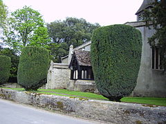
Kingston Lisle
| Kingston Lisle | |
|---|---|
 St. John the Baptist parish church |
|
| Kingston Lisle shown within Oxfordshire | |
| Population | 249 (2001 census) |
| OS grid reference | SU325876 |
| • London | 64 miles (103 km) |
| Civil parish |
|
| District | |
| Shire county | |
| Region | |
| Country | England |
| Sovereign state | United Kingdom |
| Post town | Wantage |
| Postcode district | OX12 |
| Dialling code | 01367 |
| Police | Thames Valley |
| Fire | Oxfordshire |
| Ambulance | South Central |
| EU Parliament | South East England |
| UK Parliament | |
Kingston Lisle is a village and civil parish in the Vale of White Horse, England. Kingston Lisle was part of Berkshire until the 1974 local government boundary changes transferred the Vale of White Horse to Oxfordshire.
Kingston Lisle is at the foot of the Berkshire Downs escarpment 64 miles (103 km) west of London. The local town is Wantage 5 miles (8 km) to the east, and the large town of Swindon is 10 miles (16 km) to the west. The village is at the foot of Blowing Stone Hill and is one of many spring line settlements at the foot of the scarp of the White Horse Hills. The Uffington White Horse, Uffington Castle and the Ridgeway are nearby.
The village has one public house, which is also a restaurant. The village area is served by Uffington Primary School just over 2 miles (3 km) away, to which there is a free bus service.
Kinston Lisle is also home to several racehorse trainers, being 5 miles (8 km) from the horse racing centre of Lambourn.
The Blowing Stone, King Alfred's supposed means of summoning his troops before the momentous Battle of Ashdown, is at Kingston Lisle.
The Domesday Book in 1086 records the village as having 31 households.
...
Wikipedia

