Kingsford, Michigan
| Kingsford, Michigan | |
|---|---|
| City | |

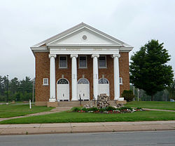
City Hall
|
|
 Location of Kingsford, Michigan |
|
| Coordinates: 45°48′12″N 88°5′5″W / 45.80333°N 88.08472°WCoordinates: 45°48′12″N 88°5′5″W / 45.80333°N 88.08472°W | |
| Country | United States |
| State | Michigan |
| County | Dickinson |
| Area | |
| • Total | 4.58 sq mi (11.86 km2) |
| • Land | 4.32 sq mi (11.19 km2) |
| • Water | 0.26 sq mi (0.67 km2) |
| Elevation | 1,099 ft (335 m) |
| Population (2010) | |
| • Total | 5,133 |
| • Estimate (2012) | 5,147 |
| • Density | 1,188.2/sq mi (458.8/km2) |
| Time zone | Central (CST) (UTC-6) |
| • Summer (DST) | CDT (UTC-5) |
| ZIP codes | 49801-49802 |
| Area code(s) | 906 |
| FIPS code | 26-43300 |
| GNIS feature ID | 0629722 |
Kingsford is a city in Dickinson County in the U.S. state of Michigan. The population was 5,133 at the 2010 census. It is part of the Iron Mountain, MI–WI Micropolitan Statistical Area.
M-95 connects with US 2 and US 141 just a mile or so north in Iron Mountain. The road crosses the Menominee River into Wisconsin where it continues as County Road N in Florence County.
Kingsford is located at 45°47′40″N 88°04′36.09″W / 45.79444°N 88.0766917°W
According to the United States Census Bureau, the city has a total area of 4.58 square miles (11.86 km2), of which, 4.32 square miles (11.19 km2) is land and 0.26 square miles (0.67 km2) is water.
Ford Airport (Iron Mountain) (KIMT) serves Kingsford, the county and surrounding communities with both scheduled commercial jet service and general aviation services.
As of the census of 2010, there were 5,133 people, 2,224 households, and 1,357 families residing in the city. The population density was 1,188.2 inhabitants per square mile (458.8/km2). There were 2,414 housing units at an average density of 558.8 per square mile (215.8/km2). The racial makeup of the city was 97.2% White, 0.4% African American, 0.4% Native American, 0.5% Asian, 0.2% from other races, and 1.2% from two or more races. Hispanic or Latino of any race were 1.1% of the population.
...
Wikipedia
