King George County, Virginia
| King George County, Virginia | ||
|---|---|---|

King George County Courthouse
|
||
|
||
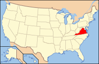
 Location in the U.S. state of Virginia |
||
 Virginia's location in the U.S. |
||
| Founded | 1720 | |
| Named for | George I | |
| Seat | King George | |
| Largest community | King George | |
| Area | ||
| • Total | 188 sq mi (487 km2) | |
| • Land | 180 sq mi (466 km2) | |
| • Water | 8 sq mi (21 km2), 4.3% | |
| Population (est.) | ||
| • (2015) | 25,515 | |
| • Density | 131/sq mi (50.6/km²) | |
| Congressional district | 1st | |
| Time zone | Eastern: UTC-5/-4 | |
| Website | www |
|
King George County is a county located in the Commonwealth of Virginia. As of the 2010 census, the population was 23,584. Its county seat is King George.
The county's largest employer is the U.S. Naval Surface Warfare Center Dahlgren Division. It is adjacent to the two-lane, 2-mile long Harry W. Nice Memorial Bridge carrying U.S. Highway 301 over the Potomac River. It contains the ZIP codes 22448 (Dahlgren) and 22485 (all other areas within King George). It is within the area code 540 and contains the exchanges: 775, 644, 663, and 653.
Indigenous peoples of varying cultures lived along the waterways for thousands of years before Europeans arrived. Among the historic Native American tribes who came into conflict with the English were the Algonquian-speaking Nanzatico. In 1704 colonists retaliated for the tribe's attacking the farm of John Rowley, "known for his disputes" with them. They captured and shipped 40 people, including children older than 12, to Antigua in the Caribbean, where they were sold into slavery.
King George County was established in 1720 when land was split from Richmond County, Virginia. The county is named for King George I of Great Britain. It was substantially reorganized in 1776 and 1777, with land swapped with both Stafford and Westmoreland Counties to form the modern boundaries.
...
Wikipedia

