Khryplyn
|
Khryplyn Хриплин |
|||
|---|---|---|---|
| Village | |||
|
|||
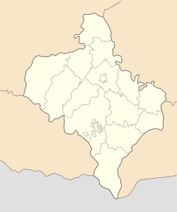
| Location of Khryplyn, Ivano-Frankivsk Oblast | |||
| Coordinates: 48°52′52″N 24°44′08″E / 48.88111°N 24.73556°ECoordinates: 48°52′52″N 24°44′08″E / 48.88111°N 24.73556°E | |||
| Country | Ukraine | ||
| Oblast | Ivano-Frankivsk Oblast | ||
| District | Ivano-Frankivsk municipality | ||
| Area | |||
| • Total | 9.58 km2 (3.70 sq mi) | ||
| Population (2001) | |||
| • Total | 1,887 | ||
| • Density | 196.89/km2 (509.9/sq mi) | ||
| Area code(s) | 380 03422 | ||
Khryplyn (Ukrainian: Хриплин) is the smallest village of the Ivano-Frankivsk municipality located in the Ivano-Frankivsk Oblast, Ukraine. It was first mentioned in 1436.
The village is located right next to the city of Ivano-Frankivsk across the river of Bystrytsia-Nadvirnyanska that makes a natural border of the village to the west and northwest. The village also sits next to another suburb of Mykytyntsi, bordering which by a railroad and the State companies of Avtolyvmash and Presmash (former Karpatpresmash) to the north east. The railroad also makes the eastern border of the village as well. To the south of Khryplyn is located the village of Cherniiv (Tysmenytsia Raion).
The whole village consists of the original settlement that stretches along its main street, Avtolyvmash Street, and a cottage settlement that is located to the west, closer to banks of Bystrytsia river. The both settlements are divided by the Bystrytsia's tributary Mlynivka.
The former mayor of Ivano-Frankivsk Zinoviy Shkutiak was looking for greenfield investments for the Kryplyn Industrial Zone.
Khryplyn Industrial-Investment Zone (Ukrainian: Хриплинська інвестиційно-промислова зона):
...
Wikipedia


